Oslofjord-Kreuzfahrt & die Fjordinseln
The Oslofjord (the 100-kilometre fjord extending south from Oslo to the Skagerrak strait between Norway and Denmark, with an average width of 2-3 km and numerous islands, islets, and beaches along its shores) is Oslo's primary natural playground and the defining feature of the city's geography: the fjord is visible from virtually every part of central Oslo, and the ferry connections to the fjord islands (Hovedøya, Gressholmen, Nakholmen, Bleikøya, and Langøyene) are among the most popular summer activities for Osloans.
- 1
Oslofjord Islands — The City's Summer Archipelago
The Oslofjord contains 40 islands accessible by public ferry from Aker Brygge (Ruter public transit ticket, from ¥65/single, May–September) — Hovedøya (the closest island, 15 min ferry, 12th-century Cistercian monastery ruins and the only tropical sandy beach in Oslo), Langøyene (swimming, camping, no motorized vehicles), and Gressholmen (wildlife reserve, 30 bird species including oystercatchers, eider ducks) are the most visited; the islands are Oslo's summer equivalent of a beach holiday compressed into 30 minutes.
- 2
Aker Brygge — Oslo's Waterfront Regeneration
Aker Brygge (the former shipyard of Akers Mekaniske Verksteder, founded 1854, converted to mixed-use waterfront 1986–1998) is Oslo's most successful urban regeneration project — the former shipbuilding halls now house restaurants, cinemas, and design shops; the quayside is Oslo's primary summer social space; the neighbouring Tjuvholmen district (2012, Renzo Piano masterplan) added the Astrup Fearnley Museum of Modern Art (2012, Renzo Piano building, ¥130 entry) and gallery row; the combined waterfront is the model for Norwegian urban development.
- 3
Bygdøy Peninsula — The Museum District by the Fjord
Bygdøy Peninsula (accessible by bus 30 or ferry from Aker Brygge, May–September) concentrates 5 major museums within walking distance — the Norwegian Maritime Museum, the Viking Ship Museum (Vikingskipshuset, 3 original 9th-century Viking ships: Oseberg, Gokstad, and Tune, ¥120), the Kon-Tiki Museum (Thor Heyerdahl's 1947 Pacific raft voyage), the Fram Museum (Roald Amundsen's polar ships), and the Norwegian Folk Museum (Norsk Folkemuseum, 160 historic buildings including a stave church, ¥180 adults).
- 4
Opera House Roof — Oslo's Most Democratic Architecture
The Oslo Opera House (Kirsten Flagstads Plass 1, Bjørvika, 2008, Snøhetta architects, Pritzker Prize nomination) has a sloped white marble roof that extends to street level and is open to the public as a rooftop walkway — the roof (accessible free, daily from 6am to midnight) is Oslo's most visited public space; the opera house's design principle ('bringing the building down to the people') is the starting point for Oslo's ongoing Fjordbyen (Fjord City) waterfront regeneration; the view from the roof apex includes the Oslofjord, Aker Brygge, and the Barcode development.
- 5
Oslofjord Kayaking — Paddling Through the City's History
Sea kayaking in the Oslofjord (rental from Sjøsportsenteret, Bygdøy, from NOK 450/hour) allows access to the inner fjord's islands and coastline from water level — the route from Aker Brygge to Bygdøy (2km, 30 minutes) passes the Akershus Fortress (14th century castle, free entry), the opera house, and multiple historic quays; the outer fjord (Drøbak area, 2 hours south by boat) has kelp forests, seals, and the narrowest point of the fjord where a German naval battle occurred in April 1940.
- 6
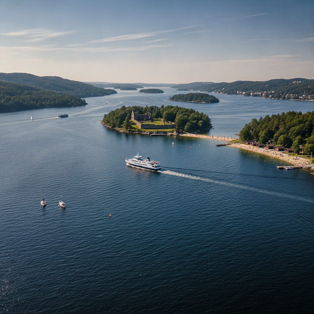
Drøbak — The Coastal Town That Sank the Blücher
Drøbak (1 hour south of Oslo by boat or bus, the narrowest crossing point of the Oslofjord) is famous for the April 9, 1940 sinking of the German heavy cruiser Blücher — the Oscarsborg Fortress (on an island in the narrowest part of the fjord) fired its 28cm Krupp cannons and torpedo tubes at the Blücher at point-blank range, sinking the ship and delaying the German invasion of Oslo by 5 hours, allowing King Haakon VII to escape with the government; the Oscarsborg museum (accessible by ferry from Drøbak) tells the story.