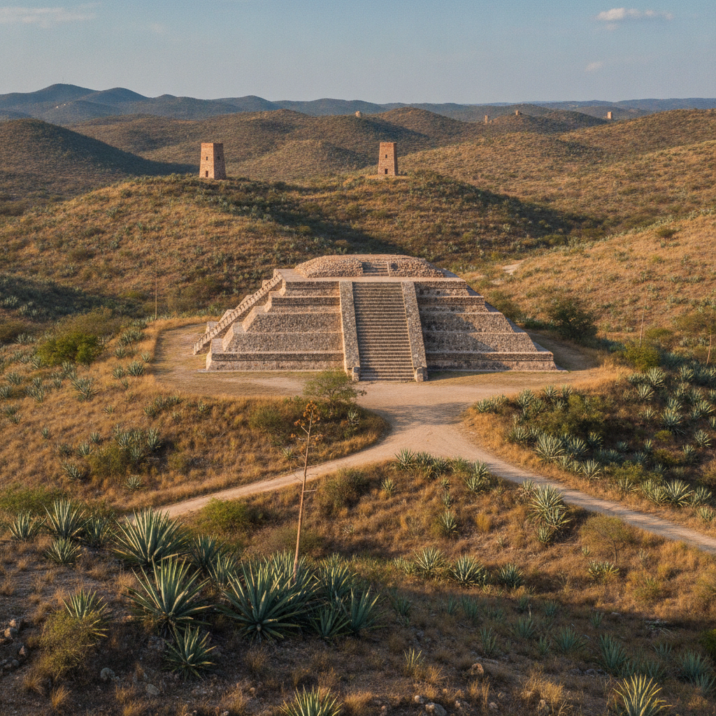
Guanajuato Pre-Hispanic Chichimec Culture the Purépecha Boundary and the Archaeological Heritage of a Region Where Three Civilizations Met at the Northern Frontier of Mesoamerican Settlement
Guanajuato state sits at the northern edge of Mesoamerica, the boundary zone where the agricultural civilizations of central Mexico encountered the semi-nomadic and nomadic cultures of the Gran Chichimeca, creating a frontier region whose pre-Hispanic history is more complex and less well understood than the histories of the core Mesoamerican regions to the south. The territory of what is now Guanajuato state was occupied in the pre-Hispanic period by a succession of cultures that included Chupicuaro, one of the most artistically productive ceramic traditions of ancient Mexico, the Purépecha empire of Michoacan whose expansion in the 15th century pushed into Guanajuato territory from the west, the Chichimec peoples whose territory extended across the semi-arid north, and the Otomi and Mazahua communities of the valleys who maintained agricultural settlements at the southern edge of the Gran Chichimeca frontier. The Chupicuaro culture, centered on the site now submerged beneath the Solis Reservoir on the border of Guanajuato and Michoacan, produced between 500 BCE and 300 CE one of the most distinctive ceramic traditions in pre-Columbian Mexico, with highly polished geometric painted vessels, female figurines with elaborate headdresses, and burial goods of exceptional quality that have been recovered in thousands of excavations since the 1940s. The site of Cañada de la Virgen, 15 kilometres from San Miguel de Allende, is the most significant accessible pre-Hispanic archaeological site in Guanajuato, with a ceremonial complex including a pyramid oriented to astronomical events that documents the presence of an agricultural settlement and ceremonial center in the Bajio highlands between 540 and 1050 CE.
- 1
Chupicuaro Ceramic Culture and Pre-Classic Guanajuato
The Chupicuaro culture, which flourished in the Lerma-Chupicuaro river valley on the border of Guanajuato and Michoacan from approximately 500 BCE to 300 CE, is one of the most significant pre-Classic ceramic traditions in Mexico, producing a body of polychrome painted pottery and female figurine sculpture that influenced the artistic development of cultures throughout western and central Mexico. The Chupicuaro ceramic tradition is characterized by geometric design painted in red, black, and cream on a buff clay body, with the repetitive diamond, chevron, and stepped fret patterns that cover the surfaces of the bowls, jars, and effigy vessels producing an aesthetic immediately recognizable in museum collections throughout Mexico and the United States. The female figurines of Chupicuaro, ranging from miniature pendants to life-sized representations, are the most recognizable objects of the tradition, depicting women with elaborate headdresses, body painting, and ritual dress that document aspects of Chupicuaro religious and social practice that the ceramic objects preserve where no written records survive. The Chupicuaro site itself, excavated urgently before its submersion beneath the Solis Reservoir in the 1940s, yielded over 400 burials with their associated ceramic grave goods in a relatively short excavation window, producing the primary reference collection now distributed between the National Museum of Anthropology in Mexico City and the Guanajuato Regional Museum. The influence of Chupicuaro ceramic designs on the pottery traditions of Teotihuacan and the cultures of west Mexico suggests that the Bajio served as a diffusion zone for artistic and technological innovations between the core Mesoamerican civilizations and the frontier regions to the north and west.
- 2
Canada de la Virgen Archaeological Site Near San Miguel
The site of Canada de la Virgen, a pre-Hispanic ceremonial complex located 15 kilometres southwest of San Miguel de Allende on a semi-arid hillside overlooking a narrow valley, was built by an agricultural community of the Bajio highlands culture between approximately 540 and 1050 CE and served as a ceremonial and administrative center whose astronomical orientations, architectural plan, and associated material culture document the complexity of the Bajio highland settlements that preceded the Chichimec dominance of the region. The site consists of five architectural groups arranged around plazas, with the main pyramid, Structure A, oriented to the sunrise on the winter solstice and containing the burial of a high-status individual with jade, obsidian, and ceramic offerings that indicate long-distance trade connections with Teotihuacan and the Gulf Coast cultures. The excavation of Canada de la Virgen by the Mexican National Institute of Anthropology and History (INAH) between 2002 and 2015 revealed the building sequence of the site, a history of construction, modification, and abandonment that correlates with the broader patterns of Bajio settlement and the climatic changes that affected the semi-arid highland region between 800 and 1000 CE. The site opened to the public in 2011 with a visitor center and guided tour program operated by the INAH, offering the opportunity to walk the ceremonial plazas, ascend the main pyramid, and understand the Bajio highland culture in its original landscape setting. The astronomical alignment of the Canada de la Virgen pyramid to the winter solstice sunrise connects the site to the broader Mesoamerican tradition of astronomical observation and the religious calendar that governed agricultural life.
- 3
Purépecha Empire and the Western Guanajuato Frontier
The Purépecha empire of Michoacan, the most powerful political entity in western Mexico during the late pre-Hispanic period from approximately 1350 to 1522 CE, expanded its territory into the western areas of Guanajuato state, establishing military garrisons and tribute relationships with communities in the valleys between the Sierra de Guanajuato and the Lerma River. The Purépecha, unlike the Aztec Triple Alliance to the east, successfully resisted Aztec expansion through a combination of military effectiveness and the geographic barrier of the Lerma basin, maintaining their independence throughout the period of Aztec expansion in the 15th century. The Guanajuato frontier of the Purépecha empire represents the easternmost extent of their political control, a zone where the Purépecha administrative presence was lighter than in the core territories of the Lake Patzcuaro region and where the Otomi, Matlatzinca, and Mazahua communities maintained a degree of autonomy within the tribute system. The Spanish conquest of the Purépecha state in 1522, achieved through the conversion of the Cazonci, the Purépecha ruler, to Christianity and his subsequent execution by Nuno de Guzman in 1530, opened western Guanajuato to Spanish colonization and the silver mining economy that would transform the entire region. The Purépecha cultural heritage in Guanajuato state is preserved in the western communities that maintain Purépecha language, artisan traditions, and ceremonial practice, representing the continuation of the pre-Hispanic culture that the colonial period modified but did not eliminate.
- 4
Chichimec Peoples and the Gran Chichimeca Frontier
The Chichimec peoples of the Gran Chichimeca, the vast territory of semi-arid and arid land extending north from the Bajio through what is now Queretaro, Guanajuato, San Luis Potosi, Zacatecas, Aguascalientes, and beyond, were a diverse group of linguistically and culturally distinct communities united in the Spanish colonial imagination by their resistance to colonization and their contrast with the agricultural civilizations of central Mexico. The Guamar, the Zacatec, the Pame, and the Chichimec-Jonaz peoples of Guanajuato state were expert hunters and gatherers who supplemented their subsistence with limited agriculture in the valley bottoms, and whose mobility, knowledge of the semi-arid terrain, and hit-and-run military tactics made them effective guerrilla fighters against the Spanish military forces during the 40-year Chichimec War from 1550 to 1590. The Mission de Chichimecas in San Luis de la Paz, Guanajuato, established in 1590 after the peace negotiations that ended the Chichimec War, is the oldest continuously inhabited Chichimec community in Mexico, where the Chichimec-Jonaz people maintain their language, a linguistic isolate unrelated to any other Mexican indigenous language, and their cultural identity through a combination of traditional ceremonial practice and contemporary community organization. The Chichimec-Jonaz language, spoken by an estimated 200 to 300 people in the Mission community, is classified as critically endangered by UNESCO and is the subject of documentation and revitalization programs by the University of Guanajuato and Mexican federal linguistic agencies. The pre-Hispanic rock art sites of the Sierra de Guanajuato, with petroglyph and pictograph panels documenting the ceremonial and cosmological expression of the Chichimec and earlier cultures, are accessible through guided programs in the protected areas of the state parks.
- 5
Guanajuato Mining Museums and Industrial Heritage
The mining heritage of Guanajuato, the most significant industrial archaeology of any Mexican state, is preserved in the historic mine infrastructure of the city and its surroundings, including the ventilation towers, reduction works, and mine entrance structures of the colonial and 19th-century operations that produced the silver wealth of the Bajio. The Bocamina San Ramon and San Cayetano, former mine entrances adjacent to the Valenciana church that have been opened as tourism sites, allow visitors to descend into the upper levels of the mine workings on guided tours that explain the colonial mining process of drilling, blasting with black powder, and hauling ore to the surface using human labor before the introduction of machinery. The Mineral de Rayas, one of the historic mining districts of Guanajuato on the hillside above the historic center, preserves the infrastructure of the colonial reduction works where silver ore was processed using mercury amalgamation, the technology that the Spanish crown introduced to New Spain in the 1550s and that dramatically increased the efficiency of silver extraction while creating the mercury pollution legacy that remains in the soils of the historic mining zones. The Museo de la Mineria de Guanajuato, housed in a former mine administration building in the historic center, presents the history of the Guanajuato mining industry from pre-Hispanic turquoise and mineral extraction through the colonial silver boom and the 20th-century industrial period. The Hacienda de Beneficio San Xavier, a colonial silver reduction hacienda whose ruins are partially accessible on the edge of the historic city, represents the processing infrastructure that transformed raw ore into the silver bars that were transported to the Royal Mint in Mexico City and ultimately to the treasuries of the Spanish empire.
- 6
Guanajuato Contemporary Issues Water Mining and Urban Growth
Guanajuato city faces the contemporary challenge of managing tourism growth within a canyon terrain that was never designed for mass visitation, with the pedestrian streets of the historic center reaching carrying capacity during the Cervantino festival and Semana Santa periods, and the infrastructure of the underground tunnels, parking, and public transport struggling to accommodate the vehicle traffic generated by the surrounding residential growth. The water supply of Guanajuato, dependent on the mountain springs of the Sierra de Guanajuato and the Presa de la Olla reservoir that has served the city since the colonial period, faces increasing pressure from the population growth of the metropolitan area including the municipalities of Leon, Silao, and Irapuato that share the Bajio aquifer system. The active silver and gold mining operations of the Guanajuato historic mining zone, continued by the Canadian mining company Endeavour Silver at the Guanajuato Mine Complex that includes the historic Valenciana mine, have generated friction with the heritage preservation authorities whose UNESCO designation requires the visual integrity of the historic landscape to be maintained while the mine operations require surface infrastructure that is visible from the protected viewpoints. The air quality of Guanajuato city, challenged by the vehicle emissions in the underground tunnels and the semi-enclosed canyon terrain that reduces air circulation, has been a persistent urban environmental concern that the municipal government has addressed through vehicle restriction programs and the promotion of pedestrian and bicycle transit in the historic center. The gentrification of the historic center colonias, less advanced than in San Miguel de Allende but following the same trajectory of boutique hotel conversion and premium restaurant investment, is beginning to displace the Mexican working-class residents who have occupied the colonial houses of the canyon slopes for generations.
Walk this route with audio
Stories play automatically as you reach each stop — no tapping needed.
More in Guanajuato
Guanajuato Walking the Callejones by Night Romantic Legends Ghost Stories and the Social Life of a Canyon City Where Every Alley Has a Story and Every Stairway Leads to a Different Century
Guanajuato Day Trips Sierra Gorda Queretaro Dolores Hidalgo and the Bajio Heritage Circuit Connecting Colonial Silver Cities Mountains and Hot Springs in the Heart of Central Mexico
The Guanajuato Independence Conspiracy Miguel Hidalgo Ignacio Allende and the Bajio Network That Launched the Mexican War of Independence From a Silver Mining City in September 1810
Guanajuato Practical Guide Getting There Navigation Tips Neighborhoods Safety Climate and How to Survive the Underground Tunnels the Cobblestone Callejones and the Most Disorienting Colonial City in Mexico
Guanajuato Baroque Art Churrigueresque Architecture La Valenciana Church and the Artistic Legacy of a Colonial City That Built the Most Elaborate Religious Buildings in Mexico With Silver Money