Lake Titicaca History: Tiwanaku, the Inca, and the Colonial Period
Lake Titicaca has been a center of Andean civilization for over 4,000 years. The Chiripa culture built ceremonial platforms on the lake shore before 500 BCE. The Tiwanaku civilization dominated the lake basin from 300 to 1000 CE, building one of the first urban centers in the Americas and developing the raised field agricultural system that transformed the lake margins into productive farmland. After the collapse of Tiwanaku, the lake region fragmented into competing chiefdoms including the Colla and Lupaka before Inca incorporation around 1450. The Spanish arrived in 1538 and established the encomienda system that organized the lake communities for silver mine labor at Potosi.
- 1
Pre-Tiwanaku Cultures: The First Lake Basin Civilizations
Human settlement around Lake Titicaca dates to at least 8000 BCE based on archaeological evidence of hunter-gatherer camps, but sedentary agricultural communities appear from approximately 2000 BCE. The Chiripa culture on the Taraco peninsula of the southern lake established one of the first ceremonial centers on the lake shore between 900 and 100 BCE, with rectangular sunken courts and mound constructions that prefigure the architectural forms of the later Tiwanaku. The Pucara culture on the northern Peruvian shore, contemporaneous with early Tiwanaku development, produced distinctive polychrome ceramics and stone sculpture that show both regional creativity and cultural exchange with the southern basin. These pre-Tiwanaku cultures demonstrate that the lake basin had been a center of complex social development for at least a millennium before the Tiwanaku state emerged to integrate them into a larger political system.
- 2
The Rise and Collapse of Tiwanaku: A 700-Year Civilization
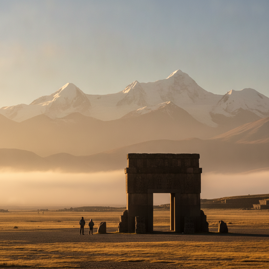
The Tiwanaku state, which dominated the altiplano from approximately 300 CE to 1000 CE, represents one of the most remarkable pre-Columbian political systems in the Americas, integrating the diverse environmental zones of the Andes, the coast, and the Amazon basin into a single redistributive economic system without a standing army or evidence of systematic warfare. The state ideology centered on the Gateway of the Sun deity and the ritual use of hallucinogenic snuff in elite ceremonies; the distinctive Tiwanaku iconography spread throughout the Andes on trade goods including ceramics, textiles, and metal objects. The collapse around 1000 CE appears to have been caused by a prolonged drought that lasted from approximately 1000 to 1100 CE, based on lake sediment and ice core evidence; the reduction in lake level destroyed the raised field agricultural system and the food surplus that supported the state structure. The collapse fragmented the lake basin into competing chiefdoms that fought each other for the following four centuries until Inca expansion incorporated them.
- 3
The Inca Incorporation: The Lake as Sacred Origin Point
The Inca incorporation of the Lake Titicaca basin under Pachacuti around 1450 CE was motivated partly by the political value of controlling the site that the Inca themselves claimed as the origin of their dynasty. The mythology of Manco Capac and Mama Ocllo emerging from the Island of the Sun to found the Inca state made the lake the most sacred geographical feature in the Inca cosmological system, and controlling it provided ideological legitimacy that reinforced the political claim to domination of the Andes. The Inca built a temple and pilgrim infrastructure on the Island of the Sun, maintained it with chosen women aqlla workers, and established a pilgrimage route from Cusco to the island that formalized the sacred connection. The existing Aymara populations around the lake were incorporated into the Tawantinsuyu tribute system, required to provide agricultural labor and military service while maintaining their local governance under Inca supervision.
- 4
Spanish Colonialism and the Lake Communities: The Mita and the Doctrina
The Spanish arrived at the lake in 1538, four years after the fall of Cusco. Francisco Pizarro assigned the lake communities to his brother Juan in encomienda, a grant of indigenous labor and tribute. The mita system, adapted from the Inca labor obligation, directed the lake populations to the Potosi silver mines, where the combination of altitude sickness at 4,090 meters, mine collapse, mercury poisoning from the amalgamation process, and brutal working conditions killed workers at a rate that required continuous demographic replacement from wider and wider recruitment zones. The doctrina system assigned Dominican and Augustinian missionaries to convert the lake communities; many churches built on the lakeshore and on the islands in the 16th and 17th centuries survive as the most tangible colonial legacy visible to visitors today. The Taquile Island church, the Amantani Island churches on both hilltops, and the Copacabana cathedral represent different phases and quality levels of this colonial religious construction.
- 5
The Boundary: How the Peru-Bolivia Border Divided the Lake
The current international border between Peru and Bolivia divides Lake Titicaca along a diagonal line that assigns the larger Lago Mayor section predominantly to Bolivia and the shallower reed-bed margins around Puno to Peru. The border was established following the War of the Pacific (1879-1884) in which Bolivia lost its Pacific coastline to Chile and the Atacama region to which the altiplano had previously connected Bolivian territory. The earlier border between the Viceroyalty of Peru and the Audiencia of Charcas had been differently drawn. The division of the lake has created administrative complexity for fishing rights, conservation management of shared species including the endemic grebe and frog, and tourism logistics for visitors wanting to experience both sides. Joint Peru-Bolivia conservation initiatives for the lake, the bi-national Autoridad Binacional Autonoma del Sistema Hidrico del Lago Titicaca, have operated since the 1990s but with limited effectiveness due to funding and political constraints.
- 6
Sillustani Chullpas: The Funeral Towers of the Pre-Inca Colla
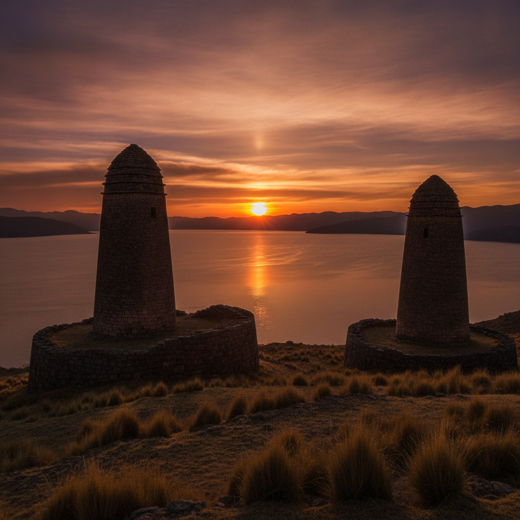
The chullpa burial towers at Sillustani, 34 kilometers from Puno on a peninsula jutting into the Laguna Umayo, represent the most impressive surviving funerary architecture of the Colla culture that dominated the northern Lake Titicaca basin in the centuries between the collapse of Tiwanaku and the Inca conquest. The towers, cylindrical or square structures reaching up to 12 meters in height, were built to house the mummified remains of Colla nobles in a fetal position surrounded by grave goods. The construction technique of some of the later towers, with stones fitted in a coursed pattern that was influenced by Inca style after the conquest of the Colla kingdom, shows the cultural transition under Inca rule. The towers were deliberately sealed and the entrances oriented east toward the rising sun in a consistent ritual pattern. The most impressive towers at Sillustani remain incomplete at the top, suggesting that construction was interrupted by the Spanish conquest before the upper section was finished. The site is typically visited as a late afternoon excursion from Puno when the low sun illuminates the stone towers against the sky.
Walk this route with audio
Stories play automatically as you reach each stop — no tapping needed.
More in Lake Titicaca
Lake Titicaca Practical Guide: Getting There, Island Visits, and Peru-Bolivia Border Crossing
Lake Titicaca Puno Festivals: The Candelaria and Altiplano Folklore
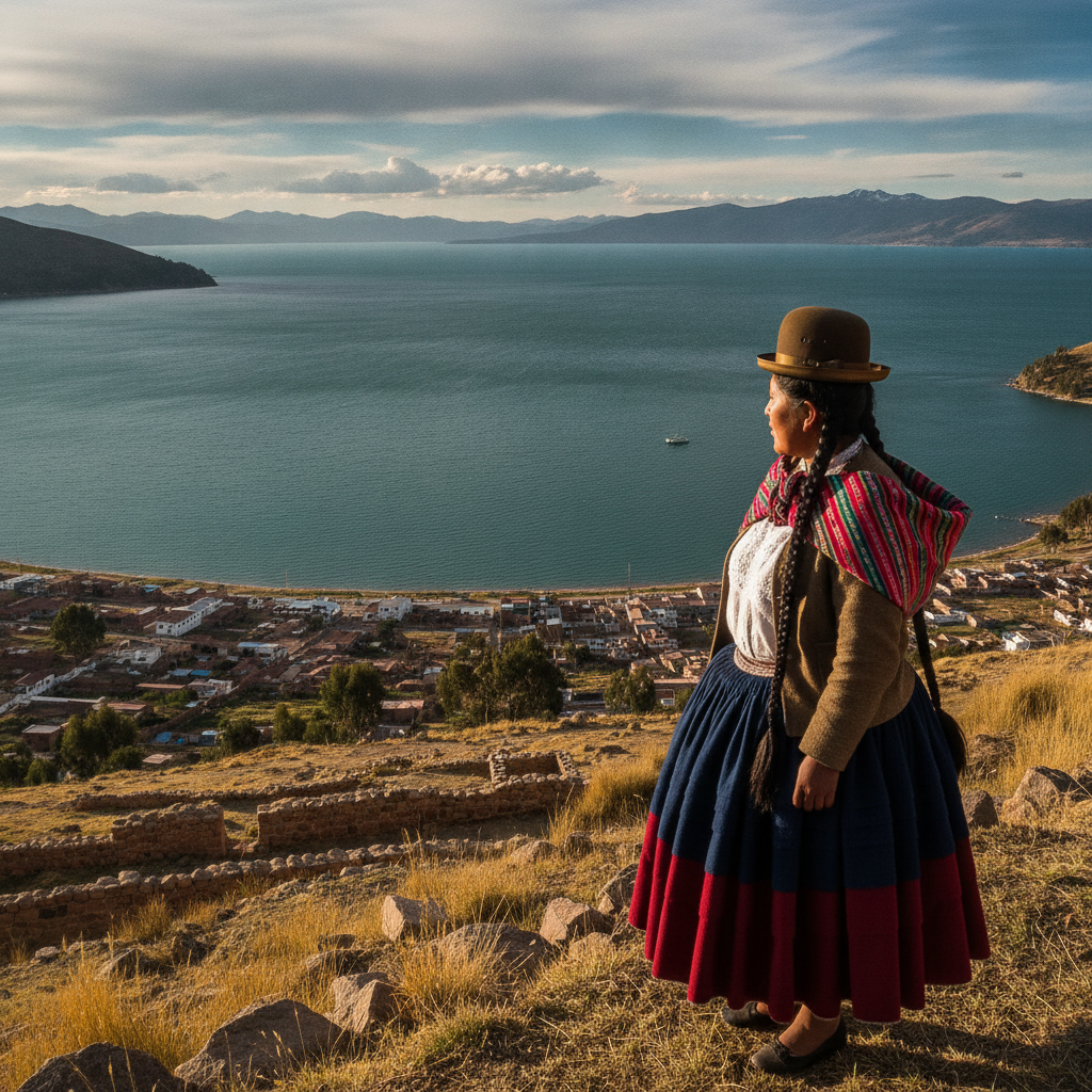
Titicaca Aymara Culture: Language, Textiles, and the Living Tradition

Lake Titicaca Birdwatching: Flamingos, Grebes, and Andean Waterbirds

Lake Titicaca: The Highest Navigable Lake and the Birthplace of the Inca