Uluru: Alice Springs and Arrernte Country, West MacDonnell Ranges Gorges and Larapinta Trail, Red Centre Desert Ecology, Dark Sky Astronomy and Anangu Star Knowledge, Uluru Statement from the Heart, Albert Namatjira Art, and Complete Red Centre Verdict
Uluru region: Alice Springs (Arrernte people, Desert Park, Flying Doctor Service), West MacDonnell Ranges gorges (Standley Chasm, Ellery Creek, Ormiston Gorge, Larapinta Trail), Red Centre ecology (thorny devil, perentie, desert oak, spinifex), Uluru dark sky and the emu constellation astronomy, Uluru Statement from the Heart (2017), and the complete two-route Uluru Red Centre verdict.
- 1
Alice Springs - the Heart of Australia
Alice Springs (population approximately 25,000): the only significant town in the Red Centre, 335 km northeast of Uluru by the Lasseter Highway and the Stuart Highway. Alice Springs history: the Arrernte people have lived in the Alice Springs area for at least 30,000 years; the permanent spring at what is now Alice Springs (Mparntwe in the Arrernte language) was a reliable water source in the desert. The European settlement: the telegraph repeater station at Alice Springs (1872) provided the first reliable communication link between Adelaide and Darwin. The Alice Springs Desert Park (the wildlife and landscape museum on the western edge of Alice Springs): the 1,300-hectare desert park showcasing the plants and animals of the three Central Australian desert habitats (the desert river, the woodland, and the sand country). The Arrernte people: the traditional owners of Alice Springs and the central ranges, with a complex and ancient social structure based on the Dreaming tracks (the songlines that connect sacred sites across the landscape). The Yeperenye (the caterpillar Dreaming): the primary Arrernte Dreaming story connected to the MacDonnell Ranges; the caterpillars that created the Ranges and the Alice Springs waterhole are the ancestral beings of the central Arrernte. The Royal Flying Doctor Service (RFDS, headquarters in Alice Springs): the air medical service that provides primary healthcare to remote Australians across 7.69 million sq km of Australia.
- 2
The West MacDonnell Ranges from Alice Springs
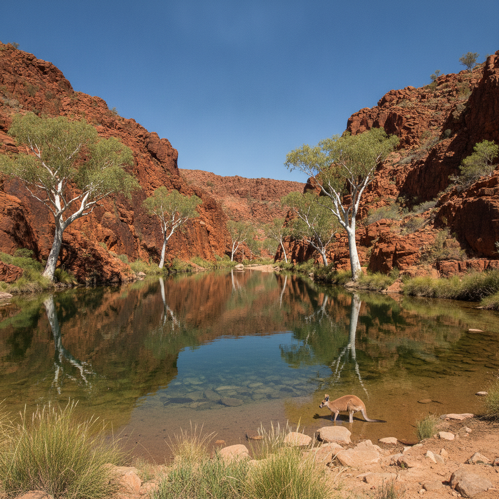
The West MacDonnell Ranges (the ancient mountain range stretching 400 km west of Alice Springs, protected as the West MacDonnell National Park): the most significant geological feature accessible from Alice Springs, with the red quartzite ridges, the permanent waterholes, and the native wildlife. The West MacDonnell gorges: Standley Chasm (the narrow quartzite gorge where the walls turn orange at midday when the sun shines directly down), Ellery Creek Big Hole (the large permanent waterhole in the quartzite gorge, the best swimming hole in the MacDonnells), Ormiston Gorge (the most dramatic gorge in the West MacDonnells, with permanent water and the ghost gum trees), Glen Helen Gorge (where the Finke River cuts through the Range), and Redbank Gorge (the narrow slot canyon requiring swimming to access the inner section). The Larapinta Trail (the 223 km walking trail from Alice Springs Telegraph Station to Mount Sonder): the premier multi-day bushwalk in central Australia, typically completed in 12-16 days in sections. The Finke River (the oldest river in the world, flowing in its current channel for approximately 350-400 million years): the river flows through the West MacDonnells and the Simpson Desert to Lake Eyre (Kati Thanda) approximately 700 km to the south. Palm Valley (in the Finke Gorge National Park): the isolated stand of Livistona mariae (the red cabbage palm), a relic from the wet tropical period of central Australia 10,000 years ago, found only in this one valley.
- 3
Desert Ecology of the Red Centre - Plants, Animals, and Adaptation
The Red Centre desert ecology: the Uluru-Kata Tjuta and MacDonnell Ranges region supports an extraordinary diversity of life despite the extreme aridity (annual rainfall approximately 275 mm, falling unpredictably, with long droughts interrupted by intense rainfall events). The Red Centre desert plants: the mulga (Acacia aneura, the most widespread tree of inland Australia), the desert oak (Allocasuarina decaisneana, the distinctive tree with its weeping foliage, endemic to the Red Centre), the ghost gum (Corymbia aparrerinja, the smooth white-barked eucalyptus of the rocky gorges, sacred to the Arrernte people), and the spinifex grasses (Triodia spp., the dominant ground cover of the sand plains). The Red Centre animals: the thorny devil (Moloch horridus, the small lizard with the body covered in thorns that channels dew and rainwater along the grooves to the mouth), the sand goanna (Varanus gouldii), the perentie (Varanus giganteus, the second largest lizard in the world, reaching 2.5 m), the red kangaroo (the world largest marsupial), and the bilby (the endangered desert marsupial with the enormous ears). The Uluru water system: the permanent waterholes at the base of Uluru (the Mutitjulu Waterhole, the primary waterhole of the Mala Dreaming story) support the highest biodiversity in the park; the water from the annual rainfall drains rapidly off the smooth rock surface, concentrating the moisture at the base.
- 4
Uluru and Kata Tjuta Night Sky - Anangu Star Knowledge
Uluru star knowledge: the Central Australian desert has some of the darkest skies in Australia (the nearest city of any size is Alice Springs, 335 km away), making Uluru one of the best locations in the world for dark sky astronomy. The Milky Way from Uluru: the full arm of the Milky Way is visible overhead from Uluru on moonless nights, with the dark star constellations (the emu in the sky, the Anangu traditional constellation formed by the dark dust lanes between the Milky Way stars) clearly visible. The Anangu astronomy: the Anangu use an astronomy based on dark constellations (the shapes formed by the dark dust clouds within the Milky Way) rather than the bright star constellations of European astronomy. The emu in the sky (Wardapi): the emu constellation formed by the dark dust lanes, used by the Anangu to indicate the emu nesting season on earth (when the emu constellation is horizontal in the sky in April-May, the emus are laying eggs and the eggs can be collected). The Uluru Astronomy Night: the guided astronomy experiences (with telescopes and guides) operated from the Ayers Rock Resort, available most nights in the dry season. The International Dark Sky Association: the Uluru-Kata Tjuta National Park has been recognized as one of the premium dark sky locations in the southern hemisphere.
- 5
Uluru in Australian Culture - Art, Literature, and National Identity
Uluru in Australian national identity: the image of Uluru has become the primary non-human symbol of Australia, used globally to represent Australia on maps, in travel media, and in cultural contexts. The Uluru name change (1993): the Australian government officially adopted the dual name Uluru (Ayers Rock) in 1993, then the primary name became Uluru in 2002 (with Ayers Rock as the secondary name in parentheses). The Uluru Statement from the Heart (2017): the statement issued by Aboriginal and Torres Strait Islander delegates at the First Nations National Constitutional Convention, held at Mutitjulu near Uluru in May 2017. The statement called for the establishment of a First Nations Voice to Parliament, a Makarrata Commission for treaty-making, and a truth-telling process. The Uluru Statement remains the most significant statement of Indigenous aspirations in Australian history. The Australian referendum on the Voice to Parliament (October 2023): the referendum to constitutionally enshrine the Aboriginal and Torres Strait Islander Voice to Parliament (as called for in the Uluru Statement) was defeated 60% to 40%. The Albert Namatjira paintings of Uluru and central Australia: Albert Namatjira (1902-1959), the Arrernte artist who developed a European watercolour style to depict the central Australian landscape, became the most famous Aboriginal artist of the twentieth century; his paintings of the ghost gums and the MacDonnell Ranges were the first Aboriginal artworks to receive widespread recognition in Australian society.
- 6
Uluru Four Routes Complete: Red Centre Verdict
Uluru four-route complete summary. Route 1: Uluru geology and Anangu people, Tjukurpa living law, sunrise and sunset light transitions, Kata Tjuta Valley of the Winds, Kings Canyon Rim Walk, practical guide and cultural protocols. Route 2 (this route): Alice Springs (Arrernte people, Desert Park, RFDS), West MacDonnell Ranges gorges and Larapinta Trail, Red Centre desert ecology (thorny devil, perentie, desert oak, ghost gum), Uluru dark sky astronomy and Anangu star knowledge, Uluru in Australian national identity (Uluru Statement from the Heart). Uluru final verdict: Uluru is one of the genuinely non-negotiable experiences in Australian travel. No photograph or screen image prepares you for the scale and presence of the rock in person; the monolith is larger, more complex, and more varied in colour and texture than any image suggests. The dawn and dusk colour transitions are genuinely extraordinary. The cultural context — understanding that you are visiting the most sacred site of the Anangu people, that the stories embedded in every feature of the rock are still living and taught, and that the land management continues in direct continuity with 10,000 years of Anangu knowledge — transforms the experience from geological tourism to something much more profound. Allow 2 full days at Uluru minimum: one for Uluru itself (dawn walk, base walk, cultural centre), one for Kata Tjuta (Valley of the Winds walk). Add a half-day for Kings Canyon if driving through.