Cape Horn and the Drake Passage: The Bottom of the World
Cape Horn, the southernmost headland of South America at 55 degrees 58 minutes south latitude on the Isla Hornos in the Chilean Wollaston archipelago, is the geographical and symbolic end of the Americas and one of the most feared and revered maritime landmarks in the world. The Drake Passage between Cape Horn and the Antarctic Peninsula is the most open and stormy ocean in the world, and rounding the Horn under sail was the defining test of seamanship in the age of square-rigged ships.
- 1
Cape Horn Headland: The Symbolic End of the Americas
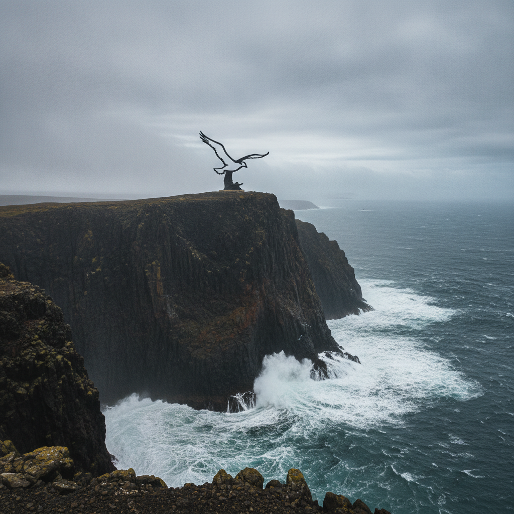
The Cape Horn headland, a 424-meter cliff of dark basalt dropping directly into the Southern Ocean, is marked by a Chilean naval lighthouse and a sculpture of an albatross installed in 1992 to commemorate the sailors who died attempting to round the Cape. The landmark is administered by the Chilean navy and is accessible by zodiac landing from expedition vessels or by helicopter from Puerto Williams; the landing conditions depend entirely on the weather and sea state, and many visitors who intend to land are prevented by the frequent storms that make the approach dangerous. The experience of standing on the Cape Horn headland, looking south into the open Southern Ocean with nothing between the standing position and the Antarctic continent 800 kilometers away, is one of the most viscerally remote locations accessible to non-specialist travelers anywhere in the world. The albatross sculpture by the Chilean artist Jose Balcells represents the albatross as the soul of a drowned sailor, reflecting the maritime folklore of the Horn that attributed moral status to the great birds that followed sailing ships through the Drake Passage. The Chilean navy maintains a small residence at Cape Horn staffed by a rotating family of the lighthouse keeper who occupies the southernmost permanent habitation in the Americas; the keeper and family can sometimes be encountered by visitors who make the zodiac landing.
- 2
The Drake Passage: Terror and Wonder of the Polar Sea
The Drake Passage, the 800-kilometer stretch of open ocean between Cape Horn and the South Shetland Islands of Antarctica, is the most exposed ocean crossing in the world because it is the only sea passage where there is no land to interrupt the circumpolarpolar wind system, allowing westerly storms to build to enormous size and generating waves regularly exceeding 10 meters and occasionally reaching 20 meters during the most violent storms. The passage is named after the English privateer Francis Drake, whose ship was driven south through the Cape Horn area after passing through the Straits of Magellan in 1578; Drake did not discover the passage in any meaningful sense as the Yamana had navigated the Cape Horn area for millennia, but his name has been attached to the body of water by the convention of European cartography. The Drake Passage crossing to Antarctica takes approximately 48 hours on modern expedition vessels at a speed of 12 to 15 knots; the crossing can range from the relatively calm conditions of a Drake Lake in the meteorological slang of expedition crew to the extreme conditions of a Drake Shake in which swells of 8 to 10 meters make movement inside the vessel dangerous. The wildlife of the Drake Passage is extraordinary for the committed seabird observer: the passage concentrates the seabird species of the Southern Ocean including several albatross species, giant petrels, prions, storm petrels, and Antarctic petrels that follow the ships through the crossing and provide continuous observation opportunities for birdwatchers on deck. The Drake Passage is increasingly crossed by sailboats as well as expedition cruise ships, with a small community of adventurers completing the crossing in vessels as small as 10 meters in what is considered one of the most challenging offshore sailing passages in the world.
- 3
Wulaia Bay: Darwin, Yamana History, and the Murder of the Matthews Mission
Wulaia Bay on the Navarino Island of the Chilean Beagle Channel was the site of Darwin's most intense observations of the Yamana people during the 1833 voyage and the location of the massacre of eight members of a missionary party in 1859, events that together define the complex and tragic history of European contact with the Fuegian peoples. Darwin observed at Wulaia the behavior of Jemmy Button, one of the four Yamana individuals taken to England by Captain FitzRoy on the first Beagle voyage, who had returned to his original community and appeared to have completely reverted to Yamana customs within months of being returned; the episode was the primary inspiration for Darwin's later reflections on human malleability and the relationship between environment and behavior. The 1859 massacre, in which Yamana individuals killed eight members of a missionary party at Wulaia Bay in circumstances that remain historically contested, effectively ended the first phase of missionary activity in the Beagle Channel and led to the eventual establishment of the more permanent mission at Ushuaia. The bay is currently a stopping point for Chilean expedition vessels that navigate the Beagle Channel south from Puerto Natales, and visitors can walk through the forest to a viewpoint above the bay where the scale and beauty of the landscape provides a powerful contrast to the violence of its historical associations. The natural history of Wulaia, with its intact sub-Antarctic forest and the evidence of Yamana shellmound middens still visible along the shoreline, makes the bay one of the most historically layered sites in the entire Fuegian archipelago.
- 4
Puerto Williams: The Southernmost Town and the Beagle Channel Crossing
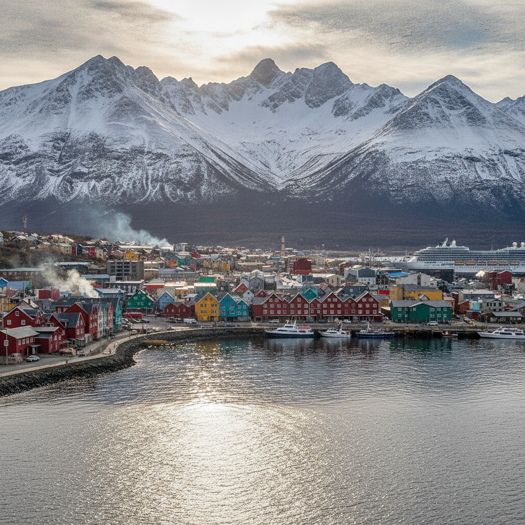
Puerto Williams, the Chilean naval base and civilian settlement on the north coast of Navarino Island opposite Ushuaia, has a legitimate claim to being the southernmost town in the world (as opposed to Ushuaia's claim as the southernmost city), with a population of approximately 2,500 inhabitants centered on the naval base and the small civilian community of fishermen, researchers, and tourism workers. The crossing from Ushuaia to Puerto Williams is available by zodiac catamaran service that takes approximately one hour in reasonable weather conditions and provides a Beagle Channel navigation experience that allows observation of the channel wildlife while also serving the practical function of reaching Chilean territory. The Dientes de Navarino trekking circuit, a 53-kilometer route through the granite peaks and glacial lakes of the Navarino Island interior, is considered the southernmost trekking circuit in the world and attracts experienced backpackers from throughout the world who prioritize remoteness and extreme-latitude achievement over comfort. The Museo Martin Gusinde in Puerto Williams, named after the German missionary and ethnographer who made the most systematic documentation of Yamana and Kawesqar culture in the early 20th century, contains ethnographic collections of indigenous material culture and historical photographs that are among the most significant resources for understanding the pre-contact cultures of the Fuegian archipelago. The southern giant petrel colony at Punta Arenas on Navarino Island is one of the accessible seabird colonies near Puerto Williams and provides close-range observation of one of the most impressive sub-Antarctic seabirds from the accessible walking tracks near the town.
- 5
Overland to Puerto Natales: The Patagonian Road Through Chilean Tierra del Fuego
The overland route from Ushuaia to Puerto Natales in Chilean Patagonia, passing through the Tierra del Fuego archipelago by ferry crossings at the Primera Angostura Straits of Magellan, is a two-day journey through some of the most dramatic and least visited landscapes of southern South America. The Ruta 3 north from Ushuaia through the Argentine Tierra del Fuego crosses the border into Chile and follows the Pan-American highway north through the rolling moorland and forest of the Chilean Tierra del Fuego province to the Primera Angostura ferry crossing at the Straits of Magellan, where a 45-minute ferry crossing connects the island to the continental mainland. The Chilean mainland section north of the Straits continues through Punta Arenas, the largest city in Chilean Patagonia and a historic port with significant early 20th century architecture from the wool boom era, before the road continues north along the southern Andes to Puerto Natales. The bus connections on this route are well established for independent travelers, with daily services covering the entire route and the ferry crossings included in the ticket; the journey can be completed in two long days or broken into segments with overnight stops in Punta Arenas. Puerto Natales, at the north end of the route, is the gateway to the Torres del Paine national park and the starting point for the W Trek and Circuit Trek, the most famous multi-day hiking routes in South America; combining the Ushuaia experience with a Torres del Paine trek creates the complete Patagonian circuit that is the ambition of most serious adventure travelers visiting the southern cone.
- 6
Cape Horn Circumnavigation: The Sailor's Ultimate Achievement
The rounding of Cape Horn under sail, from east to west against the prevailing westerly winds and the Drake Passage current, is considered the ultimate test of seamanship in the long-distance sailing tradition and is marked by the maritime custom of wearing a gold earring to mark the achievement. The historical record of Cape Horn rounding fatalities, from the beginning of the age of sail until the opening of the Panama Canal in 1914 made the route commercially obsolete, includes thousands of vessels and tens of thousands of sailors who lost their lives in the storms of the Drake Passage; the Cape Horn International Association maintains records of the circumnavigators and their vessels as a historical archive. The contemporary Cape Horn circumnavigation community, a small but active group of offshore sailors who specifically seek the challenge of the Drake Passage crossing under sail, departs from Ushuaia harbor in purpose-built or heavily modified sailing vessels for crossings that take two to four weeks depending on the conditions encountered. The record for the fastest Cape Horn rounding as part of a global circumnavigation, set by the Jules Verne Trophy racing trimarans, represents the technological opposite of the traditional square-rigger rounding: modern carbon fiber multihulls capable of speeds exceeding 40 knots that reduce the Drake crossing to hours rather than weeks. The meaning of Cape Horn as a landmark has evolved from the terror of the age of sail through the achievement of the offshore sailing community to the contemporary role as a landing destination for expedition cruise passengers; the change in the relationship between humans and the headland over five centuries reflects the transformation in maritime technology and the democratization of extreme travel.
Walk this route with audio
Stories play automatically as you reach each stop — no tapping needed.
More in Ushuaia
Ushuaia History: Penal Colony, Missionaries, Darwin, and Argentine Sovereignty
Ushuaia Practical Guide: Getting There, Costs, Booking Antarctica, and Circuit Planning
Ushuaia Hiking: Glaciers, Peaks, and Multi-Day Treks in the Fuegian Andes

Ushuaia Food, Culture, and the Frontier City Social Life
Ushuaia Wildlife: King Crabs, Penguins, Sea Lions, and the Sub-Antarctic Ecosystem