Stanley Park, the Seawall & Vancouver's Urban Wilderness
Vancouver (the largest city in British Columbia, Canada — population approximately 675,000 in the city and 2.6 million in the Greater Vancouver area — the most spectacularly situated city in North America, set between the Coastal Mountains (which rise abruptly to over 1,500 metres (5,000 feet) immediately north of the city) and the Pacific Ocean, with a temperate oceanic climate that keeps the city green year-round): Stanley Park (the 405-hectare (1,000-acre) urban park on the forested peninsula at the entrance to Burrard Inlet) is the most beloved urban park in Canada and the defining natural feature of Vancouver.
- 1
The Stanley Park Seawall — Vancouver's Greatest Urban Walk
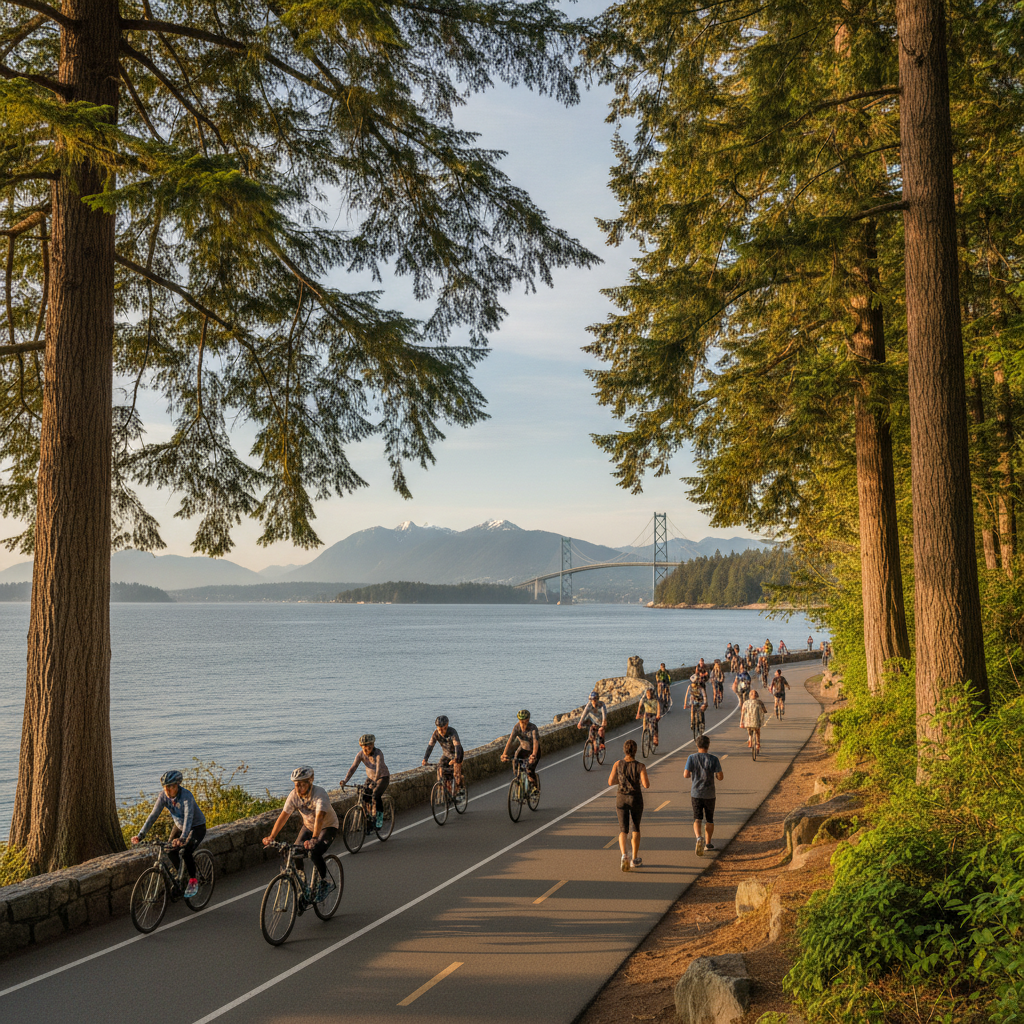
The Stanley Park Seawall (the 8.8-kilometre (5.5-mile) paved recreational path that circumnavigates the Stanley Park peninsula at the water's edge — the most popular recreational path in Canada, used by approximately 8 million people per year): the Seawall history (the Seawall was constructed over a period of 32 years (1917-1971) under the supervision of a single city engineer, James Cunningham (1877-1963) — the man who dedicated his professional life to building the seawall, beginning work as a young engineer in 1917 and completing the circumnavigation of the park in the final years before his death): the Seawall experience (the path is divided into a cycling lane and a walking lane, both running in the same counterclockwise direction around the park): the key views from the Seawall (the view from the Second Beach section (the view west across English Bay to the mountains of the Sunshine Coast and the Gulf Islands), the view from the Prospect Point section (the view under the Lions Gate Bridge to the North Shore Mountains), the view from the Brockton Point section (the view east across Burrard Inlet to the North Shore skyline and the Coastal Mountains beyond), and the view from the Coal Harbour section (the view south to the downtown Vancouver skyline, with the mountains behind)): the Lions Gate Bridge (the 473-metre (1,550-foot) suspension bridge built 1938-1939 by the Guinness family (the Irish brewing family who developed the British Pacific Properties in West Vancouver) — the bridge that crosses the First Narrows of Burrard Inlet at the northern tip of Stanley Park, the most photographed bridge in British Columbia).
- 2
Stanley Park Old-Growth Forest & Totem Poles
Stanley Park (the 405-hectare (1,000-acre) park on the forested peninsula at the western entrance to downtown Vancouver — the park that contains the finest accessible old-growth temperate rainforest in a major North American city): the old-growth forest (the approximately 40% of Stanley Park covered in old-growth Douglas fir (Pseudotsuga menziesii), western red cedar (Thuja plicata — the 'tree of life' of the Indigenous peoples of the Pacific Northwest, the tree used for canoes, longhouses, totem poles, and cedar baskets), and Sitka spruce (Picea sitchensis) — the trees that survived the 1888 windstorm that destroyed much of the park's old-growth and that have been growing for 400-800 years): the First Nations Totem Poles (the collection of 9 totem poles at Brockton Point (the eastern headland of Stanley Park, on the south shore of Burrard Inlet) — the collection assembled from 1920 to 1962 representing the work of First Nations carvers from the Kwakwaka'wakw, Haida, and other Pacific Northwest Indigenous cultures): the Lost Lagoon (the freshwater lake at the entrance to Stanley Park — originally a tidal flat of Burrard Inlet that was transformed into a freshwater lake by the construction of the causeway in 1916 — the lake named by the poet E. Pauline Johnson (Tekahionwake, 1861-1913), the Mohawk-English poet who spent the last years of her life in Vancouver and wrote about the park's lagoon in her poetry): the Vancouver Aquarium (the research aquarium at the centre of Stanley Park — the largest aquarium in Canada, with 65,000 animals representing 750 species, and the primary centre for marine mammal rescue in British Columbia).
- 3
English Bay & Vancouver's Beach Culture
English Bay (the bay at the western end of the Burrard Inlet system, facing south toward the Olympic Mountains of Washington State — the bay that fronts the West End neighbourhood and whose beaches (English Bay Beach, Second Beach, Third Beach) are the most popular outdoor gathering spaces in Vancouver): English Bay Beach (the main beach at the foot of Denman Street in the West End neighbourhood — the urban beach that is the social centre of Vancouver's outdoor beach culture): the beach culture (Vancouver's beach culture — the culture of outdoor recreation and socializing on the beaches of English Bay, the most active of any Canadian city's beach culture, sustained by the mild climate (the January average temperature is 4°C (39°F) and the July average is 22°C (72°F) — temperatures that allow year-round outdoor recreation of a kind impossible in most of Canada)): the Celebration of Light (the annual international fireworks competition held over English Bay in late July and early August — the largest fireworks competition in the world, with competing national teams from 4 countries putting on synchronized fireworks displays over English Bay on consecutive evenings, watched by approximately 500,000 people on the surrounding beaches (English Bay Beach, Second Beach, Sunset Beach, and Vanier Park) on each night of the competition): the West End neighbourhood (the densely populated residential neighbourhood surrounding English Bay — one of the most densely populated urban neighbourhoods in Canada, with approximately 45,000 people in the 1.3 km² (0.5 sq mile) area between Stanley Park and downtown Vancouver, the neighbourhood that is the heart of the LGBTQ+ community in Vancouver (the Davie Village — the stretch of Davie Street between Burrard Street and Jervis Street that is Vancouver's primary gay neighbourhood, with rainbow crosswalks and street lamps displaying pride flags year-round)).
- 4
Granville Island — Vancouver's Market and Arts Hub
Granville Island (the small artificial peninsula (originally a sandbar dredged in 1915 to create an industrial site) under the Granville Street Bridge in False Creek, now the most visited neighbourhood in Vancouver — approximately 12 million visitors per year): the Granville Island Public Market (the covered public market at the north end of Granville Island — the most popular public market in western Canada, with approximately 50 permanent food vendors and dozens of visiting farmers' market vendors, selling: the freshest Pacific seafood (the halibut (Hippoglossus stenolepis — the Pacific halibut, the largest flatfish in the Pacific Ocean, reaching up to 2.7 metres (8.8 feet) in length and 363 kg (800 lb) in weight — the most prized commercial fish of the Pacific Northwest), the Dungeness crab (Metacarcinus magister — the Pacific crab that is the primary crustacean of Pacific Northwest seafood culture, named for Dungeness Bay on the Olympic Peninsula of Washington State), the spot prawns (Pandalus platyceros — the BC spot prawn, the largest shrimp species on the Pacific Coast of North America (up to 23 cm / 9 inches long), prized for the firm, sweet flesh and available fresh at the Granville Island market during the May-June spot prawn season, the most anticipated seafood event on the Vancouver calendar): the other vendors (the cheese sellers, the charcutiers, the BC fruit and vegetable vendors, and the prepared food stalls that make the Granville Island Market the finest food market in western Canada)): the arts community (the 300+ artists' studios, galleries, and theatres on Granville Island, including the Emily Carr University of Art + Design (the art and design school moved to a new campus on the south shore of False Creek in 2017), the Granville Island Brewing (the craft brewery established 1984 — the first craft brewery in western Canada), and the Revue Stage and Waterfront Theatre).
- 5
Capilano Suspension Bridge & North Shore Adventures
Capilano Suspension Bridge (3735 Capilano Road, North Vancouver — the suspension footbridge crossing the Capilano River in the coastal temperate rainforest of North Vancouver, one of the most visited attractions in British Columbia): the Capilano Suspension Bridge (the 137-metre (450-foot) long, 70-metre (230-foot) high suspension footbridge originally built 1889 by George Grant Mackay and later opened to the public by the current owners — the bridge that hangs above the Capilano River Gorge in the old-growth Douglas fir and western red cedar forest of the Capilano River Regional Park): the Treetops Adventure (the elevated boardwalk through the forest canopy at the Capilano Suspension Bridge Park — the series of 7 suspension bridges linking the platforms suspended in the old-growth Douglas fir trees at 30 metres (100 feet) above the forest floor): Grouse Mountain (6400 Nancy Greene Way, North Vancouver — the ski mountain immediately north of Vancouver, accessible by the Grouse Mountain Gondola (the 8-minute gondola ride from the base of Capilano Road to the 1,231-metre (4,039-foot) summit of Grouse Mountain, the most dramatic urban gondola ride in Canada (the view from the gondola in the first 2 minutes is entirely of the old-growth forest of Grouse Mountain, and then the gondola emerges above the treeline to reveal the full panorama of the Lower Mainland and the Georgia Strait)): the skiing and snowboarding at Grouse Mountain (the mountain with 26 ski runs, the most lit night skiing terrain in Canada, and the closest ski mountain to a major Canadian city (the Grouse Mountain gondola base is 15 minutes by car from downtown Vancouver)).
- 6
Gastown & Vancouver's Historic Neighbourhood
Gastown (the neighbourhood in the northeast corner of downtown Vancouver, bounded by Water Street, Columbia Street, Hastings Street, and Carrall Street — the oldest surviving neighbourhood in Vancouver and the site of the original settlement of 'Gastown' (the informal settlement that grew up around the saloon of John 'Gassy Jack' Deighton (1830-1875) in 1867, the settlement that preceded the official incorporation of the City of Vancouver in 1886)): the Gastown neighbourhood (the neighbourhood that was the commercial and social centre of early Vancouver until the 1890s, declined into a skid row from the 1950s through the 1970s, and was designated a National Historic Site of Canada in 1971 and subsequently revitalized as an arts, restaurant, and boutique shopping district): the Gastown Steam Clock (the steam clock at the corner of Water Street and Cambie Street — the clock built in 1977 by horologist Raymond Saunders, powered by the underground steam system of the Vancouver steam heat network, and famous for whistling (playing the Westminster Chimes melody) on the quarter hour by releasing steam through the clock's steam-driven whistles — the most photographed object in Vancouver and the primary tourist attraction of Gastown): the Water Street restaurants and boutiques (the cobblestone street of Water Street lined with the converted warehouse buildings of the 1880s-1900s that house boutique clothing stores, design galleries, restaurants, and bars).