Wellington: Maori History (Te Rauparaha, Ka Mate Haka), Wellington Earthquake Risk, Greater Wellington Outdoors, Nightlife and LGBTQ Scene, Accommodation Guide, and Complete Capital City Assessment
Wellington: te Whanganui-a-Tara Maori history (Te Rauparaha and Ngati Toa, the Ka Mate haka, Treaty signing at Kapiti), Wellington earthquake risk (Wellington Fault, 1855 Wairarapa earthquake), Orongorongo and Hutt River outdoor trails, Wellington nightlife and LGBTQ scene, accommodation guide, and the complete Wellington capital city assessment.
- 1
Maori Wellington - Te Whanganui-a-Tara
Te Whanganui-a-Tara (the Maori name for Wellington Harbour, meaning the great harbor of Tara): named for Tara, the ancestor of the Taranaki iwi who settled the harbor region. The Wellington region iwi: Ngati Toa Rangatira (the iwi of Te Rauparaha, who conquered the Wellington region in the 1820s and signed the Treaty of Waitangi in 1840), Port Nicholson Block hapu (the original inhabitants of the harbor), and Ngai Tahu (the South Island iwi with interests in the Cook Strait). Te Rauparaha (approximately 1760-1849): the war chief of Ngati Toa who composed the haka Ka Mate (the same haka now performed by the All Blacks before international matches), captured the Wellington and Kapiti Coast region, and signed the Treaty at Kapiti Island in 1840. The Ngati Toa settlement (2012, NZD 110 million): the Treaty settlement compensating Ngati Toa for the loss of their Wellington and Marlborough territory through Crown purchases and actions in the 1840s-1850s. The Wellington Treaty of Waitangi: the signing ceremony for the South Island and Cook Strait region was held at Kapiti Island on 19-20 May 1840.
- 2
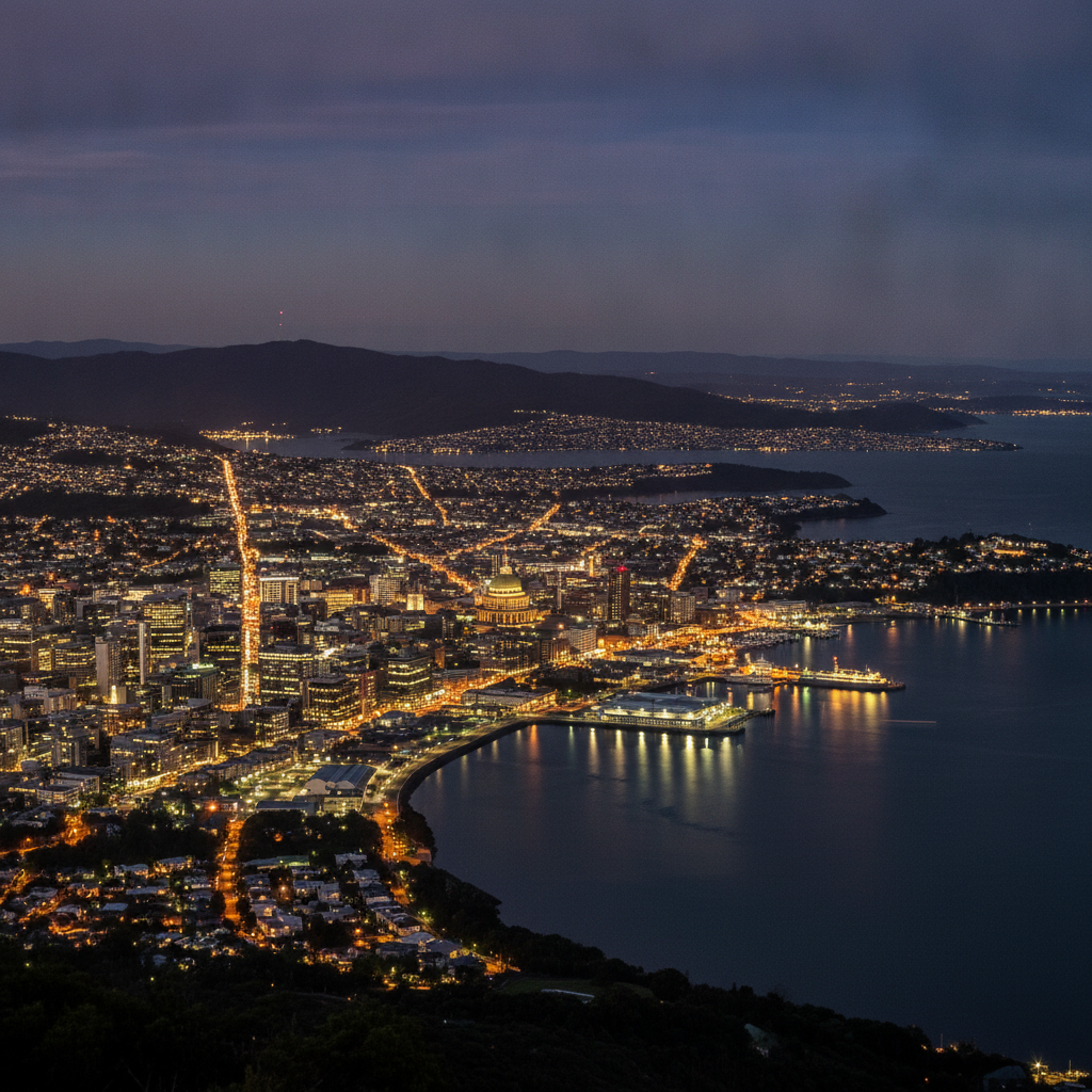
Wellington Earthquake Risk and the Alpine Fault
Wellington and seismic risk: Wellington sits directly on the Wellington Fault (running through the center of the city) and is close to the Wairarapa Fault (which caused the major 1855 Wellington earthquake). The 1855 Wairarapa earthquake (magnitude 8.2, the largest earthquake in recorded New Zealand history): uplifted the southern Wellington coastline by 1-2 meters, draining swampland and creating the flat land on which much of central Wellington now sits. The Wellington Fault: runs through the Hutt Valley, across the harbor floor, and through the western suburbs of Wellington; a major rupture on the Wellington Fault could cause a magnitude 7.5 earthquake with catastrophic damage in the city center. The GeoNet network (operated by GNS Science from Lower Hutt): the national seismic and volcanic monitoring network for New Zealand, with real-time earthquake data. The Wellington region earthquake preparedness: the Wellington City Council has the most detailed earthquake preparedness programs of any New Zealand city, with the ShakeOut national earthquake drill (annual), the household emergency kits requirement, and the unreinforced masonry building remediation program.
- 3
The Hutt River Trail and Greater Wellington Outdoors
The Hutt River Trail (the 52 km trail from Upper Hutt to Wellington Harbour along the Hutt River): the primary off-road cycling and walking trail in the Wellington region, suitable for all fitness levels. The Orongorongo Track (in the Rimutaka Forest Park, accessed from the Catchpool Valley): the most accessible native bush tramp in the Wellington region, with the stream crossings and the mature podocarp forest (rimu, kahikatea, totara) of the Orongorongo Valley. Mount Kaukau (445 m, the summit with the radio transmitter masts visible from Wellington): the most popular short summit hike from the Wellington suburbs, with 360-degree views of Wellington, the Hutt Valley, the Kapiti Coast, and on clear days the South Island across the Cook Strait. The Red Rocks Coastal Walk (the 4 km walk from Owhiro Bay to Red Rocks, on the Wellington south coast): the wild coast walk past the red iron-rich rocks and (in winter) the New Zealand fur seal colony at Red Rocks. The Makara Peak Mountain Bike Park (in the Karori suburb, adjacent to Zealandia): the 300-hectare mountain bike park with 45 km of purpose-built trails, from beginner flow tracks to expert enduro descents, one of the best urban mountain bike parks in the southern hemisphere.
- 4
Wellington Nightlife, Music, and LGBTQ Scene
Wellington nightlife: despite its smaller size (compared to Auckland), Wellington has consistently been rated the best nightlife city in New Zealand, with a concentration of bars, live music venues, and clubs per capita unmatched in the country. The Wellington music scene: Wellington has produced significant New Zealand musicians including Fat Freddy Drop (dub/soul band), The Phoenix Foundation, and Fly My Pretties (the collaborative musical project). The San Francisco Bath House (now Meow, on Edward Street): the historic venue that was the epicenter of Wellington alternative music in the 1990s-2000s. The Rogue and Vagabond (on Garrett Street, Te Aro): the multi-roomed bar with the outdoor courtyard, one of the most-loved bars in Wellington. The Library bar (on Courtenay Place): the bar above the Wakefield Street plaza, known for its cocktail list. Wellington LGBTQ scene: Wellington is widely regarded as the most LGBTQ-friendly city in New Zealand (ahead of Auckland), with the Cuba Street precinct as the center of LGBTQ life. The Wellington Pride Festival (annual in March): the primary LGBTQ cultural event in Wellington, with the Wellington Pride March and associated events. New Zealand was the 13th country in the world to legalize same-sex marriage (2013).
- 5
Wellington Accommodation and Getting Around
Wellington accommodation: the Intercontinental Wellington (the primary five-star hotel, on Grey Street near the Beehive), the QT Wellington (the boutique design hotel with local New Zealand art in each room), and the Bolton Hotel (the all-suite property in the Lambton Quay area) are the leading mid-range and luxury options. Budget Wellington: the Nomads Fat Camel Hostel (on Cuba Street) and the Downtown Backpackers (on Wakefield Street, near the waterfront) are the primary backpacker options. The YHA Wellington (on Cambridge Terrace) is the large hostel near the Courtenay Place entertainment precinct. Wellington transport: the city is compact and walkable; Wellington Airport is only 6 km from the city center (15-20 minutes by taxi or Super Shuttle). The Metlink bus network covers all suburbs and runs until approximately midnight. The Wellington Cable Car (from Lambton Quay to Kelburn, running every 10 minutes): NZD 5 one-way, NZD 9 return. Cycling Wellington: the flat waterfront (from the Airport to the CBD) is excellent for cycling; the city hills require e-bikes or fitness. The Lime and Flamingo electric scooter networks are available throughout the CBD and inner suburbs.
- 6
Wellington Four Routes Complete: Capital City Assessment
Wellington four-route complete assessment. The Wellington case: why a capital city of only 215,000 people (440,000 greater region) is one of the most important travel destinations in New Zealand. The unique Wellington combination: the world southernmost capital + the world most accessible predator-free ecosanctuary (Zealandia, within city limits) + world-class free national museum (Te Papa) + the most significant film industry legacy of any city its size (Weta Workshop, Peter Jackson) + the Cook Strait crossroads (ferry to the South Island, gateway between two worlds). Wellington vs Auckland for visitors: Auckland (1.7 million people) has more international restaurants, more nightlife options, and direct international flights; Wellington (440,000 in greater region) has more concentrated cultural attractions, a more walkable city center, and a more distinctive character. The recommendation: if New Zealand is a first visit, fly into Auckland and out of Queenstown (or reverse), spending 2-3 days in Wellington in between. If returning, Wellington rewards a deeper visit (4-5 days) to explore the surrounding region (Wairarapa, Kapiti Coast, Rimutaka Trail). Wellington is never the wrong choice.