Yaletown, False Creek e il Successo del Design Urbano di Vancouver
Yaletown (the neighbourhood on the north shore of False Creek in downtown Vancouver — the former Canadian Pacific Railway maintenance yard converted after 1986 into the most successful high-density residential development in the history of Canadian urbanism) and False Creek (the tidal inlet that bisects the south side of the Vancouver downtown peninsula, with the Granville Island Public Market on its north shore and the 2010 Winter Olympics Athletes' Village on its south shore) define Vancouver's reputation as one of the best-planned and most liveable cities in the world.
- 1
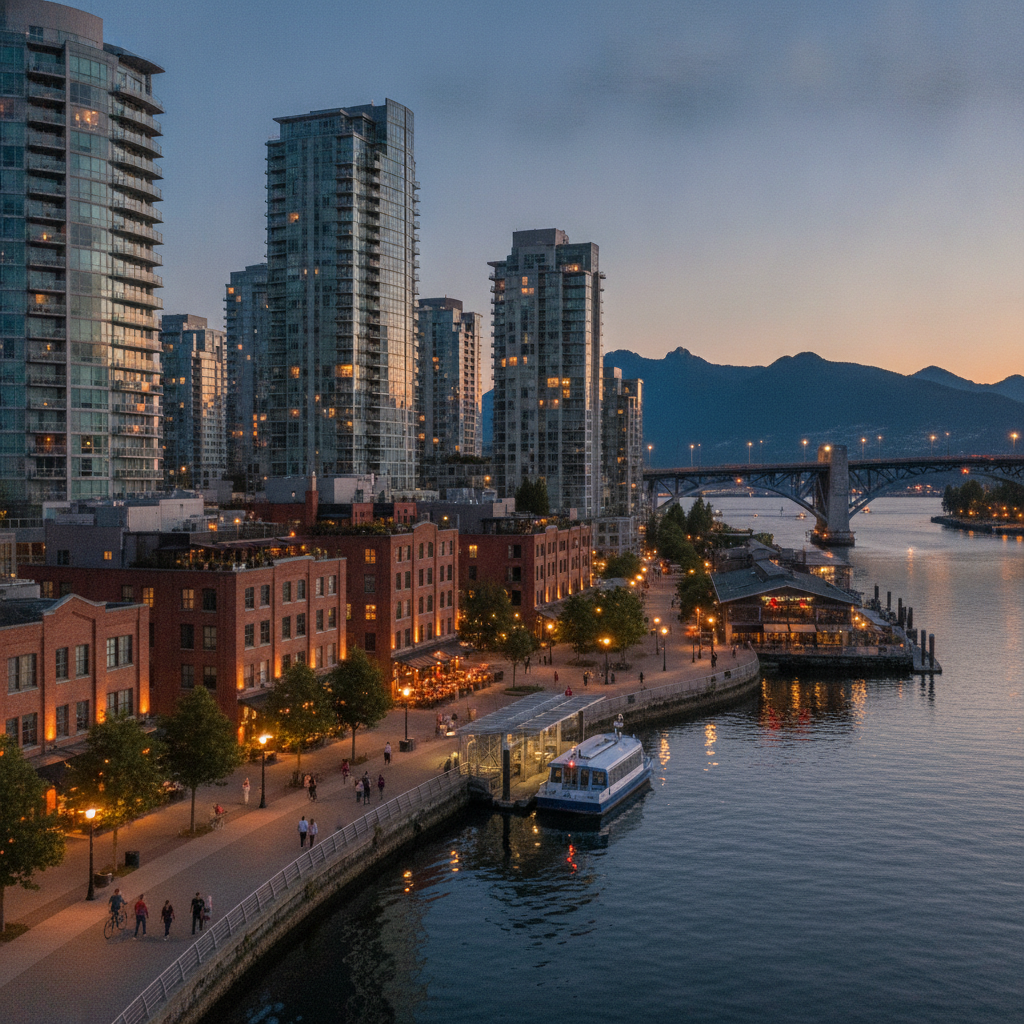
Yaletown — The Warehouse District Transformed
Yaletown (the former CPR rail yard warehouse district, bounded by Pacific Boulevard, Homer Street, Davie Street, and Seymour Street, the neighbourhood that transformed after Expo 86 established the site and accelerated development from 1990) is the benchmark for Canadian industrial heritage conversion to upscale residential and commercial use — the loading dock heritage buildings (converted to restaurants and retail, with the original steel loading ramp canopies intact as exterior seating areas — specifically along Mainland Street, Hamilton Street, and Davie Street) preserve the architectural character while accommodating entirely new uses; Yaletown is now Canada's most densely populated neighbourhood at 6,000 residents per km².
- 2
False Creek — The Expo 86 Site as Urban Waterfront
False Creek (the former industrial inlet extending 3km from Burrard Bridge to Clark Drive, entirely reconverted after Expo 86 as a mixed residential, commercial, and park waterfront) is the most successful post-industrial waterfront conversion in Canada — the Aquabus and False Creek Ferries (the small passenger ferries connecting Granville Island, Yaletown, Science World, and Stamps Landing, ¥4–7 per crossing, the fastest and most pleasant transit in Vancouver) and the False Creek Seawall (the 4.5km continuous waterfront path from the Burrard Bridge to Science World, part of the 22km Seawall that is the longest uninterrupted waterfront path in the world) are the principal public infrastructure.
- 3
Granville Island — The Public Market and Arts District
Granville Island (the 14-hectare former industrial site under the Granville Bridge, operated by Canada Mortgage and Housing Corporation, accessible by Aquabus from the south end of Thurlow Street or by bus 50, free entry) is the most visited destination in British Columbia after Whistler — the Public Market (the daily 9am–7pm market with 100 permanent vendors: Benton Brothers Fine Cheese, Oyama Sausage, the Go Fish outdoor fish and chips stand at the island's east parking lot, the benchmark for fish and chips in Vancouver) and the Emily Carr University of Art + Design (the arts school that occupies the island's east buildings) are the anchors; the market is most accessible on weekdays (weekend crowding is extreme).
- 4
Science World — The Geodesic Dome at the Creek's End
Science World at TELUS World of Science (1455 Quebec Street, the geodesic dome at the east end of False Creek, the 1986 Expo Centre designed by Bruno Freschi, now a science museum, ¥29 adults, daily 10am–5pm) is the most recognizable structure in Vancouver — the 47m dome is visible from the Science World SkyTrain station (the Canada Line, adjacent); the permanent galleries (the feature gallery, the Sara Stern Gallery for younger children, the outdoor Ken Spencer Science Park) and the OMNIMAX Theatre (¥8 surcharge, the films are primarily nature documentaries) serve the local family audience; the dome's mirror-ball sphere exterior (the original Expo 86 pavilion's geodesic structure is the same building, extended and renovated in 1989 for Science World's opening) is the iconic Vancouver skyline element from the east.
- 5
Olympic Village — The 2010 Paralympic Athletes Village
Olympic Village (Southeast False Creek, the residential neighbourhood built to house 2,800 athletes and officials for the 2010 Winter Olympic Games, converted to private market and social housing after the Games) represents the most ambitious community-level LEED Platinum environmental building project in Canada — the neighbourhood (the Central Heat system distributing thermal energy from a single biomass plant, the green roofs, the rainwater recycling system) covers 13 hectares on the south shore of False Creek; the Salt Building (the 1930 industrial building adapted to anchor the Olympic Village plaza), the waterfront walkway, and the Tap & Barrel restaurant at the water's edge are the visitor-accessible elements.
- 6
Vancouver's North Shore Mountains — The Ski Hills Above the City
Grouse Mountain (the ski area 20 minutes from downtown Vancouver by SkyBus from Canada Place or Lonsdale Quay, ¥65 adults day pass in winter, ¥35 gondola in summer) is visible from downtown Vancouver — the capacity to ski 1,211m vertical directly above a city of 700,000 is unique in North America; Cypress Mountain (the Olympic freestyle skiing and snowboarding venue 2010) and Mount Seymour (the community ski area) complete the three north shore ski areas all within 45 minutes of Vancouver's downtown; in summer, the Grouse Grind (the 2.9km hiking trail gaining 853m vertical, nicknamed 'Mother Nature's Stairmaster', ¥15 for the gondola down, the hike up is free) is the most-used trail in British Columbia with 100,000+ ascents per year.