san-francisco
Entdecke Routen, Sehenswürdigkeiten und Reiseführer in San Francisco.
9 Routen
Haight-Ashbury, Golden Gate Park & das Erbe der Gegenkultur der 1960er Jahre
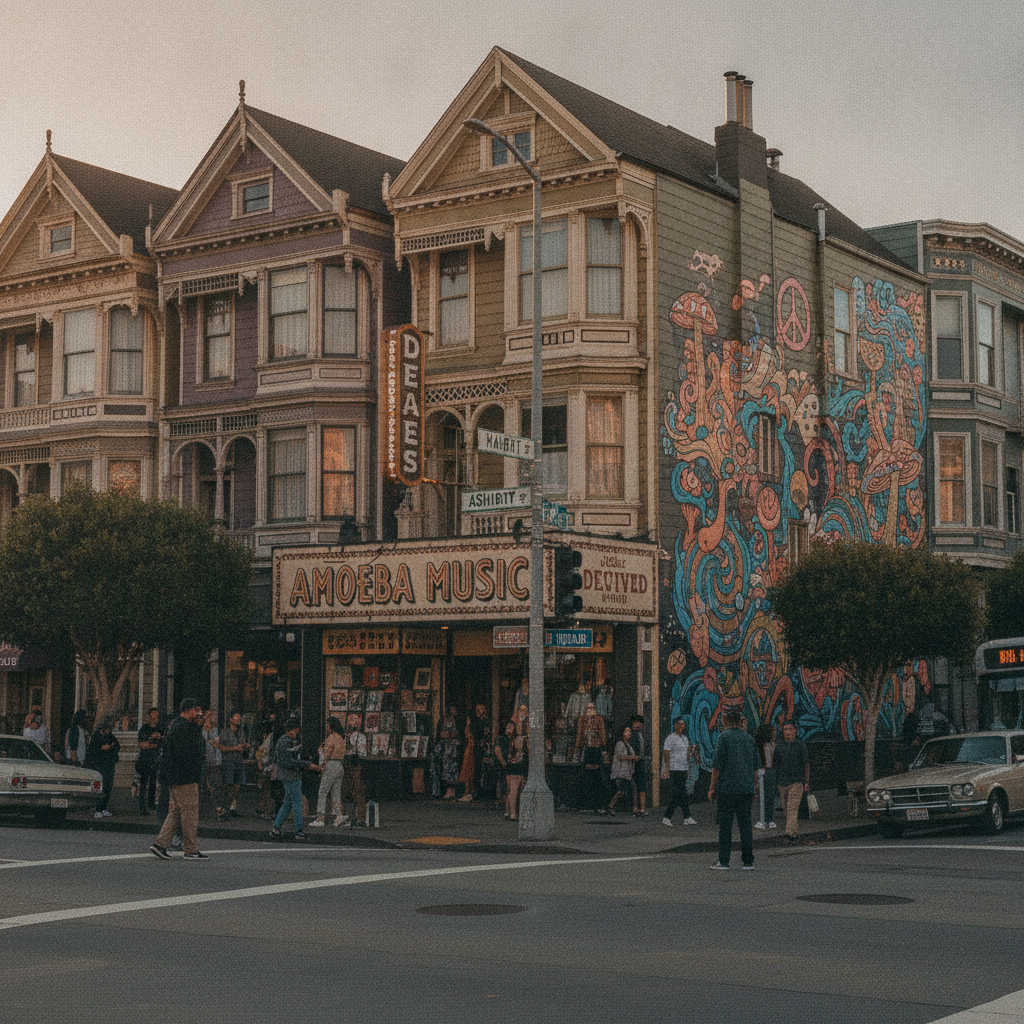
The Haight-Ashbury neighbourhood — the Victorian residential district west of Buena Vista Park that became the epicentre of the 1967 Summer of Love and the psychedelic counterculture movement, and that today preserves more of the visual and commercial character of that era than any other neighbourhood in San Francisco — and the adjacent Golden Gate Park (the 3 miles by half-mile rectangular park that constitutes San Francisco's largest green space) are the twin anchors of western San Francisco's cultural and recreational landscape.
Tagesausflug ins Silicon Valley — Stanford, Tech-Kultur & die Halbinsel
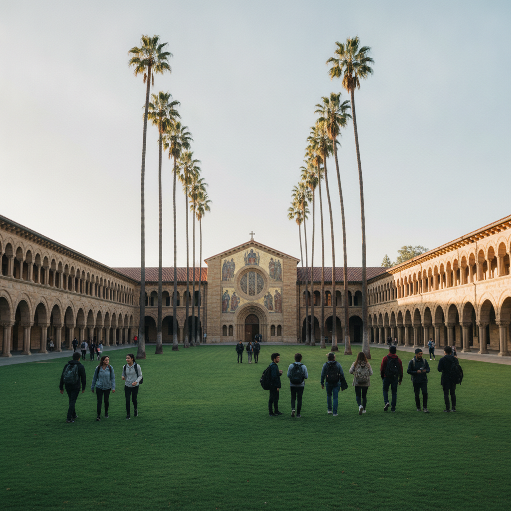
Silicon Valley — the colloquial name for the southern San Francisco Bay Area, roughly corresponding to Santa Clara County, that has been the global centre of the technology industry and venture capital since the 1970s, when the semiconductor industry established itself in the region and the combination of Stanford University's engineering programmes, a culture of entrepreneurial risk-taking, and available venture capital created the conditions for the most productive innovation ecosystem in modern economic history.
Das Mission District — Wandgemälde, Dolores Park & das San Francisco Burrito
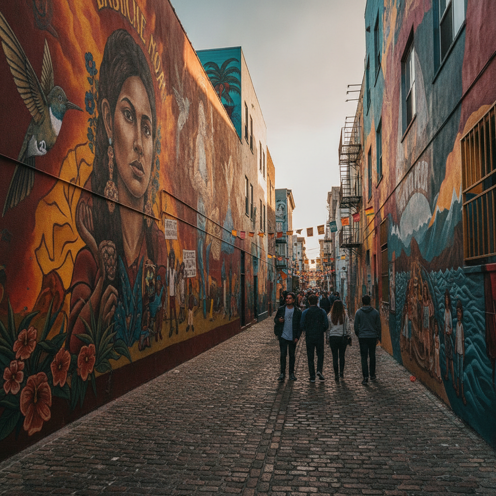
The Mission District — the historically Latino neighbourhood of eastern San Francisco, centered on Mission Dolores (the oldest surviving building in San Francisco, established 1776 simultaneously with the Presidio as the sixth in the chain of California missions) and today the most culturally diverse and artistically vibrant neighbourhood in the city — is the birthplace of the Mission burrito (the enormous foil-wrapped rice-and-beans burrito developed in the 1960s by restaurants on Mission Street as a full meal in a tortilla).
Golden Gate Bridge, Marin Headlands & Baker Beach
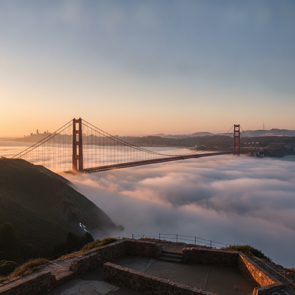
Die Golden Gate Bridge — die Hängebrücke, die die San Francisco Bay mit dem Pazifischen Ozean verbindet, 1937 fertiggestellt und weithin als schönste Brücke der Welt geltend — ist das definierendes Wahrzeichen von San Francisco und eine der bekanntesten Strukturen der Menschheitsgeschichte.
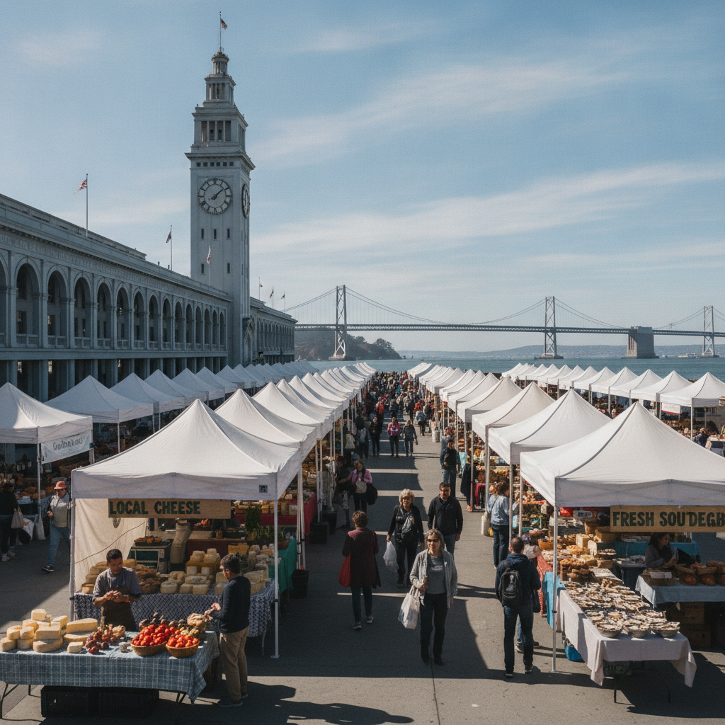
Das Ferry Building, der Embarcadero & die Bay Bridge — San Franciscos Waterfront
The Embarcadero — the boulevard running along the eastern (Bay) waterfront of San Francisco from the Bay Bridge in the south to Fisherman's Wharf in the north — is the historic economic spine of San Francisco, the place where the city's identity as a Pacific port was established and where the Gold Rush (1848-1855) transformed a small Mexican pueblo into the largest city on the West Coast of North America.
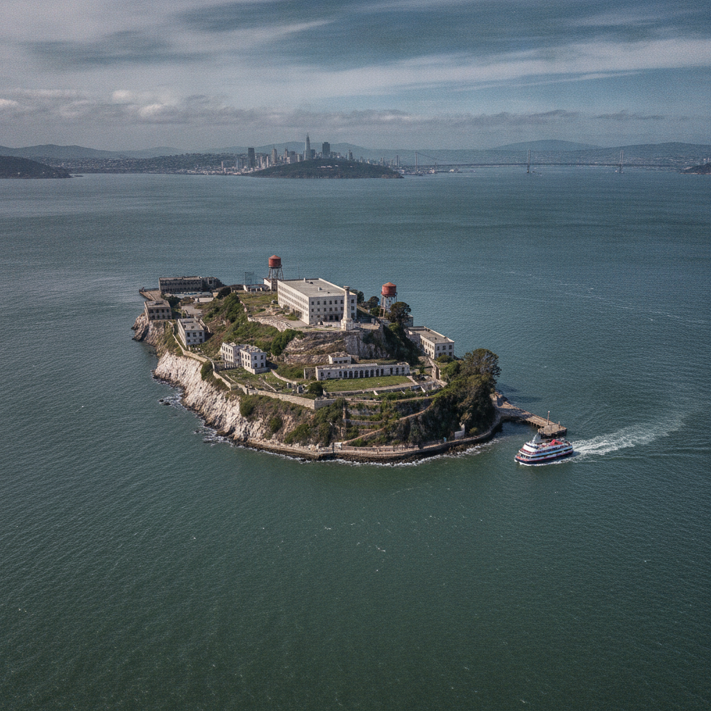
Alcatraz Insel — Der Felsen, Bundesgefängnis & die Bay-Tour
Alcatraz Island — the 22-acre island in the middle of San Francisco Bay, 2.4 kilometres offshore, that served successively as a US Army fortification (1850s), a military prison (1861-1934), and the federal penitentiary known as 'The Rock' (1934-1963, housing America's most dangerous and high-profile federal prisoners including Al Capone, George 'Machine Gun' Kelly, and Robert Stroud the 'Birdman of Alcatraz') — is the most visited site in the entire National Park System after the Washington Monument.
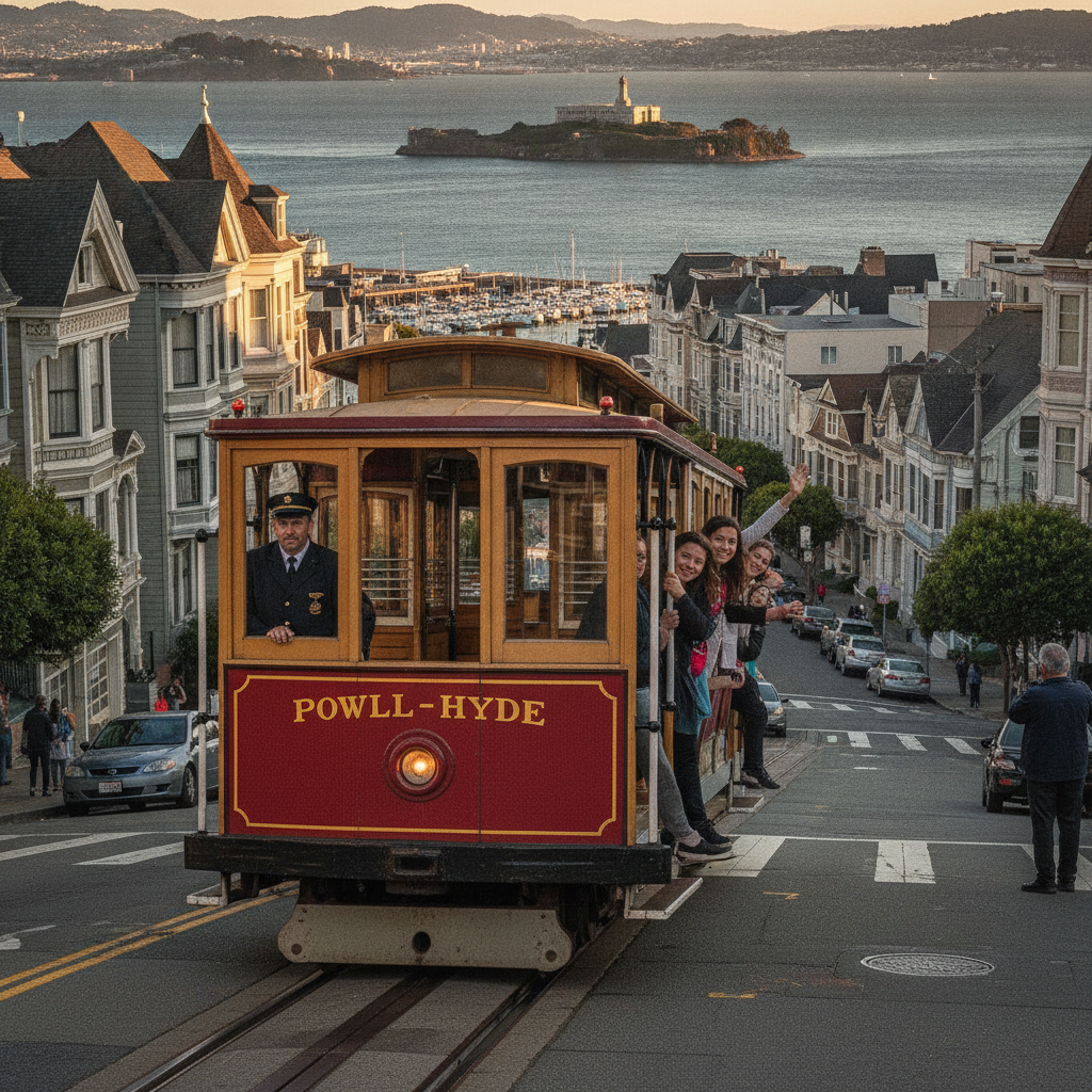
Fisherman's Wharf, Pier 39, Cable Cars & Chinatown
The tourist core of northern San Francisco — the waterfront from Fisherman's Wharf to the Ferry Building, connected to the downtown core by the Powell-Hyde and Powell-Mason cable car lines — encompasses the most iconic elements of San Francisco's public image: the sea lions of Pier 39, the dungeness crab of the Wharf, the Victorian cable cars climbing Nob Hill, and the dense commercial streets of the oldest and most established Chinese-American community in the United States.
Nob Hill, Grace Cathedral & die Viktorianische Architektur von San Francisco
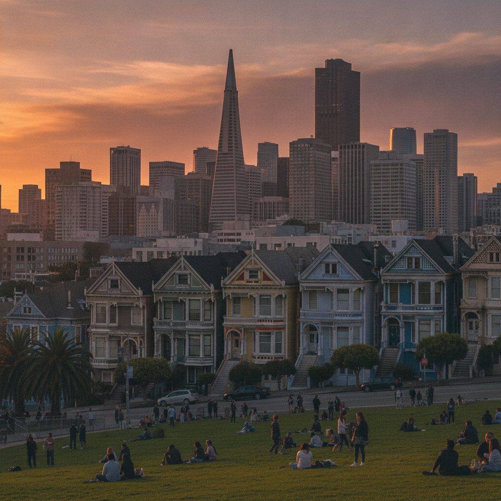
San Francisco's Victorian residential architecture — the 'Painted Ladies' and Queen Anne, Eastlake, Italianate and Stick-style Victorian houses built in enormous numbers between the 1860s and 1906 earthquake (when approximately half the city's building stock was destroyed by the earthquake and subsequent fire) — is the most distinctive and celebrated feature of the city's built environment and the visual element that most immediately distinguishes San Francisco from every other American city.
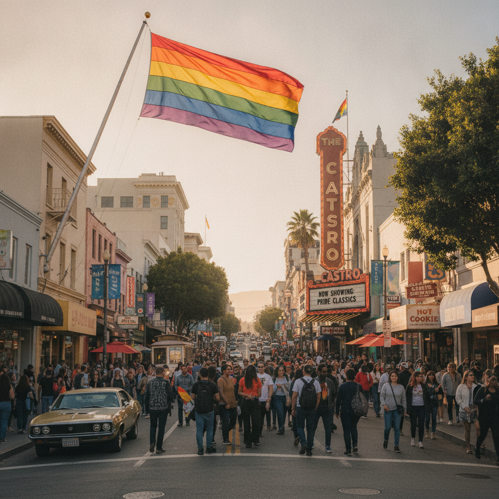
The Castro, Twin Peaks & die LGBTQ+-Geschichte von San Francisco
The Castro — the neighbourhood in west-central San Francisco that became, from the late 1960s onwards, the most famous and historically significant LGBTQ+ neighbourhood in the world — is the site where the modern American gay rights movement took political form, where Harvey Milk became the first openly gay person elected to public office in California (as San Francisco city supervisor in 1977), and where the AIDS epidemic of the 1980s-90s devastated a generation of the neighbourhood's residents.