 Mexico
Guanajuato
Guanajuato Walking the Callejones by Night Romantic Legends Ghost Stories and the Social Life of a Canyon City Where Every Alley Has a Story and Every Stairway Leads to a Different Century
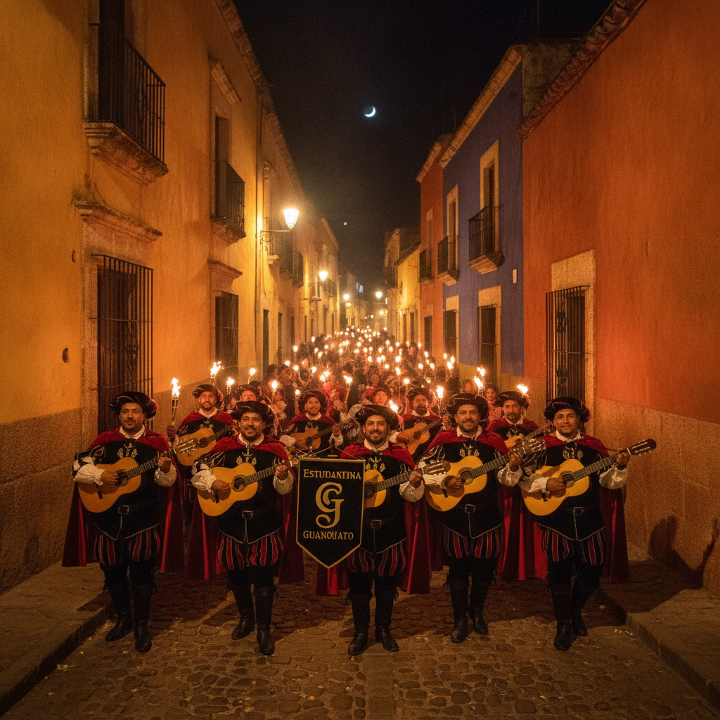
Guanajuato is the most experientially rich walking city in Mexico, a canyon labyrinth of callejones, stairways, plazas, and underground passages where the act of navigation is itself the entertainment, and where the density of history, legend, and social life compressed into the silver mining canyon produces the feeling that each turn of a narrow alley opens onto a different period of Mexican history. The callejoneadas, the guided night walks through the callejones led by estudiantina musicians in medieval costume, are the defining tourism experience of Guanajuato, a participatory performance in which the music, the torchlight, the legends of tragic love and colonial ghosts, and the social energy of the group moving through the dark alleys creates the atmosphere that the city's architecture sets the stage for. The ghost legend tradition of Guanajuato, rooted in the city's history of plague, mining accidents, executions, and the dramatic display of the mummified bodies in the Pantheon, is one of the richest in Mexico, with specific haunted locations in the callejones, the Alhondiga, the former convent buildings, and the underground tunnels that the estudiantina guides incorporate into the callejoneada narrative. The Callejon del Beso, the Callejon de la Condesa, the Callejon del Estudiante, and the Callejon de la Cantarranas each carry their own legend and their own social character, from the romantic tradition of the kissing balconies to the student bar energy of the cantarrana frog district. The night walk culture of Guanajuato, with the plazas animated by street musicians, the cantina doors open to the sounds of the estudiantinas and the ranchera music, and the food vendors lighting up the callejon entrances with their gas stove flames, constitutes the sensory experience that most visitors remember as the essential Guanajuato.
Guanajuato Day Trips Sierra Gorda Queretaro Dolores Hidalgo and the Bajio Heritage Circuit Connecting Colonial Silver Cities Mountains and Hot Springs in the Heart of Central Mexico
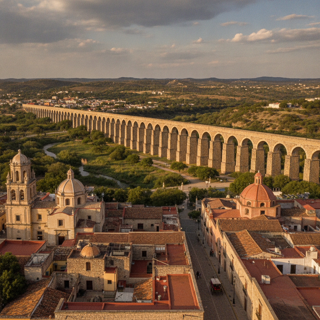
Guanajuato city is the hub of a regional heritage circuit that connects six UNESCO World Heritage Sites within a radius of 200 kilometres, including the historic center of Queretaro, the missions of the Sierra Gorda, and the independence heritage monuments of Dolores Hidalgo and San Miguel de Allende, making the Bajio region the densest concentration of colonial heritage in Mexico outside of Mexico City. The regional circuit is serviced by frequent bus connections between the major cities, with Guanajuato functioning as the overnight base from which visitors access the surrounding destinations on day trips or multi-day extensions. The Sierra Gorda of Queretaro, a UNESCO World Heritage biosphere reserve 150 kilometres east of Guanajuato on the road to Mexico City, contains five Franciscan mission churches built in the 18th century under the direction of Fray Junipero Serra before his transfer to California, whose facades represent the most elaborate example of indigenous artisan execution of European Baroque design in Mexico, with Pame and Chichimec craftsmen encoding pre-Hispanic cosmological symbols into the Catholic decorative program in a process of creative resistance that art historians call indigenous baroque. The thermal springs of Comanjilla, 30 kilometres west of Guanajuato near Leon, provide the outdoor thermal pool experience in a highland landscape that the wellness tourism market values, with water temperatures of 40 to 50 Celsius fed from the volcanic hydrothermal system of the Bajio. The Guanajuato to San Luis Potosi highway passes through the dramatic desert landscape of the Llanos de Ojuelos, where the semi-arid plateau of the Bajio transitions to the true desert of the north, and where the colonial-era haciendas of the silver transport route survive as ruins in the landscape.
The Guanajuato Independence Conspiracy Miguel Hidalgo Ignacio Allende and the Bajio Network That Launched the Mexican War of Independence From a Silver Mining City in September 1810
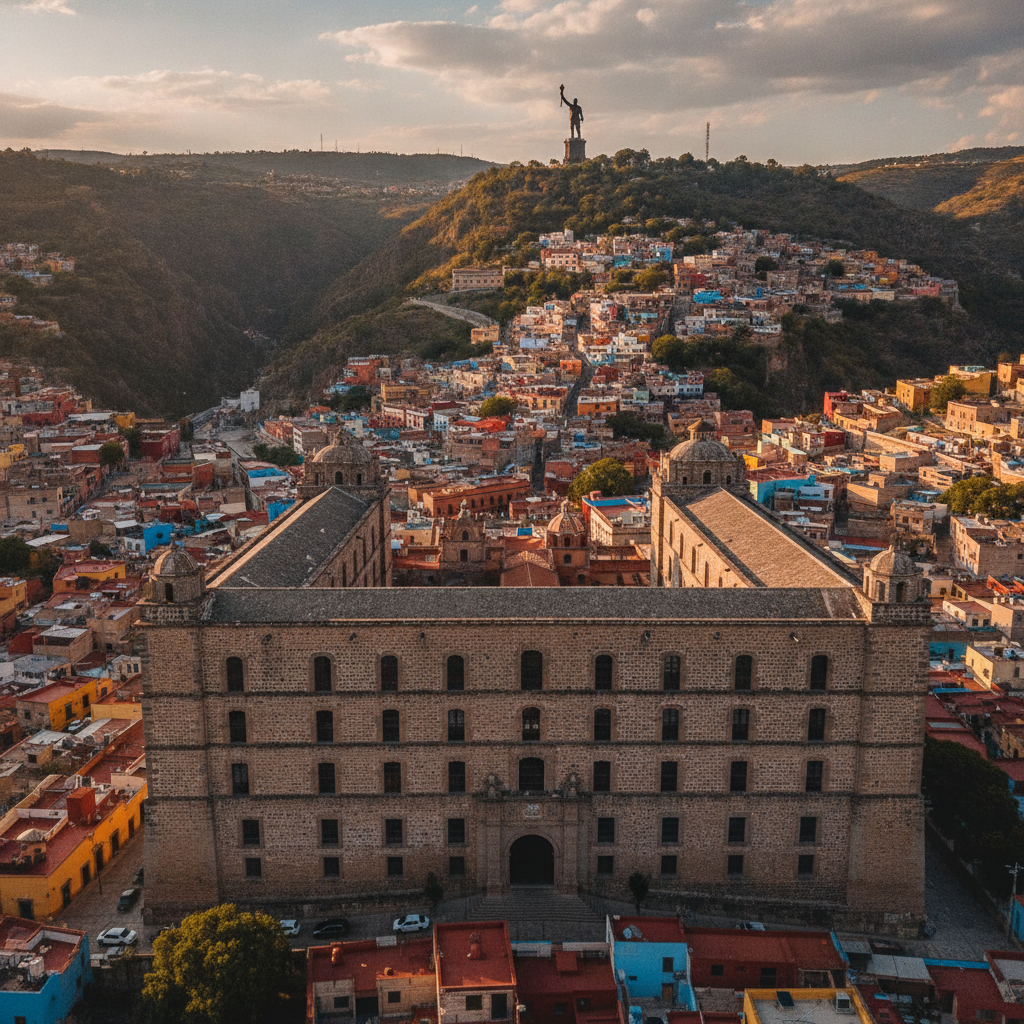
The Mexican War of Independence conspiracy that culminated in the Grito de Dolores on September 16, 1810, was organized largely within the social and geographic network of the Bajio cities, with Guanajuato as the wealthiest and most strategically important city in the region. The intendancy of Guanajuato, the colonial administrative unit that covered the territory of the modern state, was the richest province in New Spain due to the silver production of the Guanajuato and Zacatecas mines, making its control the central strategic objective of both the insurgent and loyalist forces in the early independence conflict. Miguel Hidalgo y Costilla, the parish priest of Dolores whose Grito launched the insurgency, had spent years in Guanajuato as a student at the Colegio de San Nicolas and maintained the intellectual and social connections with the Guanajuato criollo elite that made him a natural leader for the regional conspiracy. Ignacio Allende, the Guanajuato military officer from San Miguel el Grande who became the military commander of the independence movement, had participated in the Guanajuato social elite that gathered in the tertulias and literary societies of the city to discuss the Enlightenment ideas filtering in from Europe and the example of the American and French revolutions. The insurgent capture of Guanajuato in September 1810 and the storm of the Alhondiga de Granaditas was the first major military action of the independence war, a victory that also became the defining atrocity that alienated moderate opinion and set the pattern for the bloody decade of conflict that followed before independence was achieved in 1821.
Guanajuato Practical Guide Getting There Navigation Tips Neighborhoods Safety Climate and How to Survive the Underground Tunnels the Cobblestone Callejones and the Most Disorienting Colonial City in Mexico
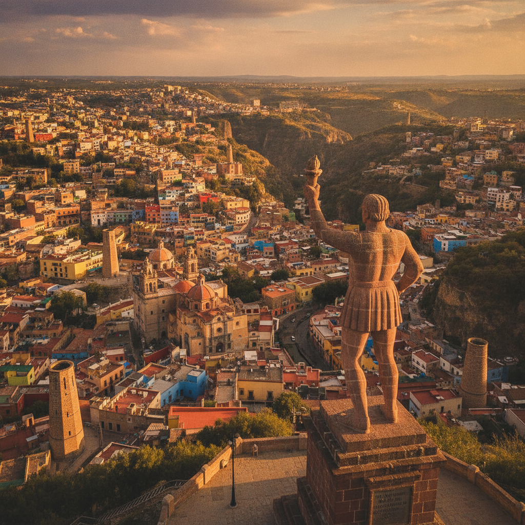
Guanajuato city is the most navigationally challenging destination in Mexico, a fact that is not incidental but essential to its character: the canyon terrain, the absence of a street grid, the underground tunnel vehicle routes, and the callejones that connect the levels of the city create an urban environment that disorients even experienced travelers and that rewards the surrender of conventional navigation logic in favor of exploration by landmark and landmark recognition. The practical experience of arriving in Guanajuato is itself an adventure: the bus from Leon descends into the city through the tunnel system, emerging at the underground bus station level from which passengers ascend by escalator or stairs to the street level of the historic center, having traveled through the stone-walled tunnels that replaced the old riverbed. The primary accommodation zone of Guanajuato is the historic center, defined by the Jardin Union, the Teatro Juarez, and the University building, within walking distance of all major monuments, restaurants, and the callejones that constitute the essential Guanajuato experience. The altitude of Guanajuato at 2,000 metres above sea level produces the temperate climate characteristic of the Mexican highland, with daytime temperatures of 18 to 26 Celsius in the dry season from October through May, cool nights of 8 to 14 Celsius requiring a jacket for evening walks, and the afternoon thunderstorms of the June through September rainy season that clear quickly and refresh the city. The October Cervantino festival period is the most crowded and expensive time to visit Guanajuato, with hotel prices at their maximum and the streets at their most animated; the spring period of March through May offers the best combination of weather, manageable crowds, and the lower prices of the mid-season.
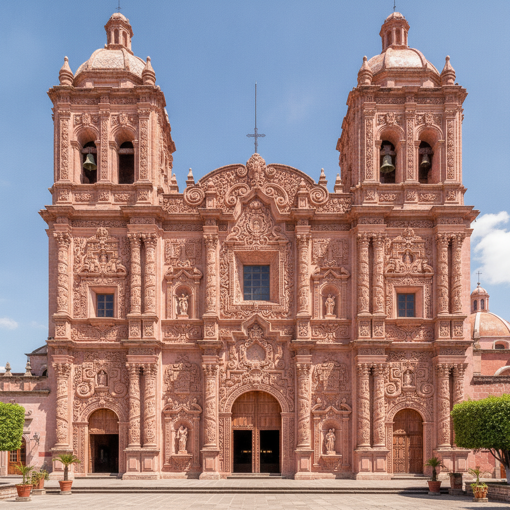
Guanajuato Baroque Art Churrigueresque Architecture La Valenciana Church and the Artistic Legacy of a Colonial City That Built the Most Elaborate Religious Buildings in Mexico With Silver Money
The baroque architecture of Guanajuato, funded by the extraordinary wealth of the silver mining economy from the late 17th through the early 19th centuries, produced a concentration of churrigueresque churches, colonial mansions, and civic buildings that UNESCO recognized in 1988 as a World Heritage Site of Outstanding Universal Value. The churrigueresque style, named for the Spanish architect Jose Benito Churriguera and characterized by the estipite column, a tapered inverted obelisk replacing the classical column, combined with dense sculptural programs covering every surface of the facade, reached its most elaborate expression in Mexico in the church buildings of the colonial Bajio, where the silver wealth available for patronage exceeded what comparable European cities could mobilize. The Templo de San Cayetano de la Valenciana, built adjacent to the Valenciana silver mine between 1765 and 1788 with funding from the mine owner Antonio de Obregon y Alcocer, is considered the finest churrigueresque church in Guanajuato state and one of the best preserved examples of the style in Mexico, with a facade of pink cantera stone whose spiral estipite columns, sculptural niches, and dense ornamental carving represent the mature Bajio Baroque at its most accomplished. The Basilica de Nuestra Senora de Guanajuato, the primary parish church of the city, preserves the 9th-century wooden image of the Virgin of Guanajuato that Philip II of Spain gave to the city in 1557, making it one of the oldest Christian images in Mexico. The Templo de la Compania de Jesus, the former Jesuit church on the main street whose facade is the most photographed baroque architecture in the city center, anchors the colonial religious heritage of the street level while El Pipila watches from above.
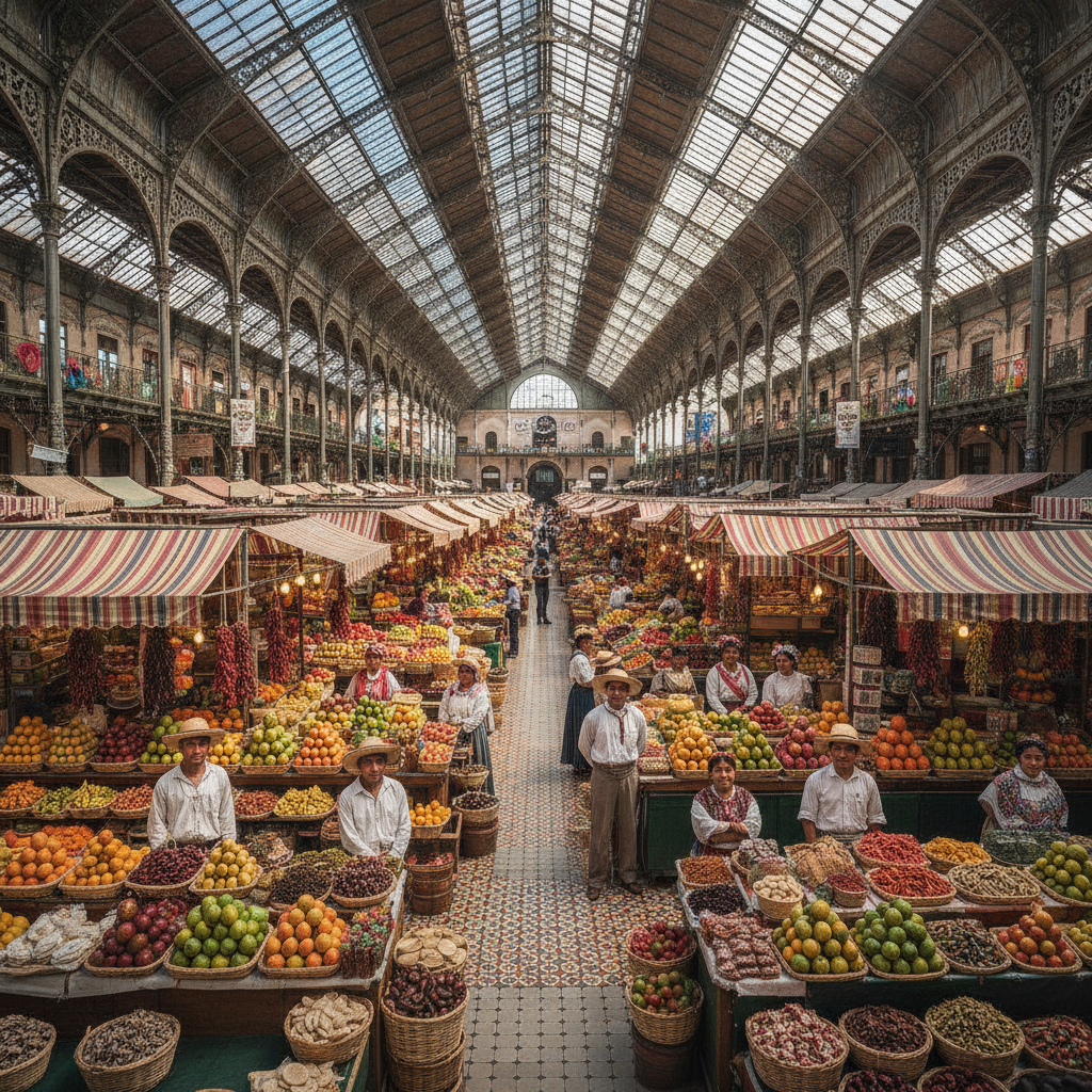
Guanajuato Food Cajeta Enchiladas Mineras Mercado Hidalgo and the Working Class Cuisine of a Silver Mining City Where the Miners Diet and the Aristocrats Table Developed Side by Side for Three Centuries
The cuisine of Guanajuato reflects the dual economy of the silver mining city: the working-class food of the miners, muleteers, and market vendors who fed the colonial labor force, and the aristocratic table of the mining elite who imported Spanish and then French culinary fashions to the colonial capital. The Guanajuato culinary identity is most strongly expressed in cajeta, the goat milk caramel produced in Celaya at the southern edge of the Bajio that has become a nationally distributed brand, and in the enchiladas mineras, the chile-sauced tortilla preparation that takes its name from the miners of the Guanajuato silver economy and that remains the signature street food of the city today. The Mercado Hidalgo, the iron-and-glass market building constructed in 1910 on the model of the French iron market halls of the 19th century, is the center of food commerce in Guanajuato, with stalls selling the dried chiles, herbs, fresh vegetables, and prepared foods of the regional kitchen alongside the artisan crafts and souvenir items that the tourist economy demands. The gorditas de nata, thick corn masa cakes enriched with nata, the cream skimmed from boiled milk, cooked on a comal and sold warm with fresh cheese and salsa, are the morning street food of Guanajuato markets, available from the vendors of the Mercado Hidalgo and the street stalls of the callejones. The guajillo and ancho chile-based sauces that define the Guanajuato kitchen connect the city to the broader dried chile tradition of the Mexican plateau, where the preservation of chiles in their dried form allowed year-round availability of the flavor complexity that fresh chiles provide only seasonally.
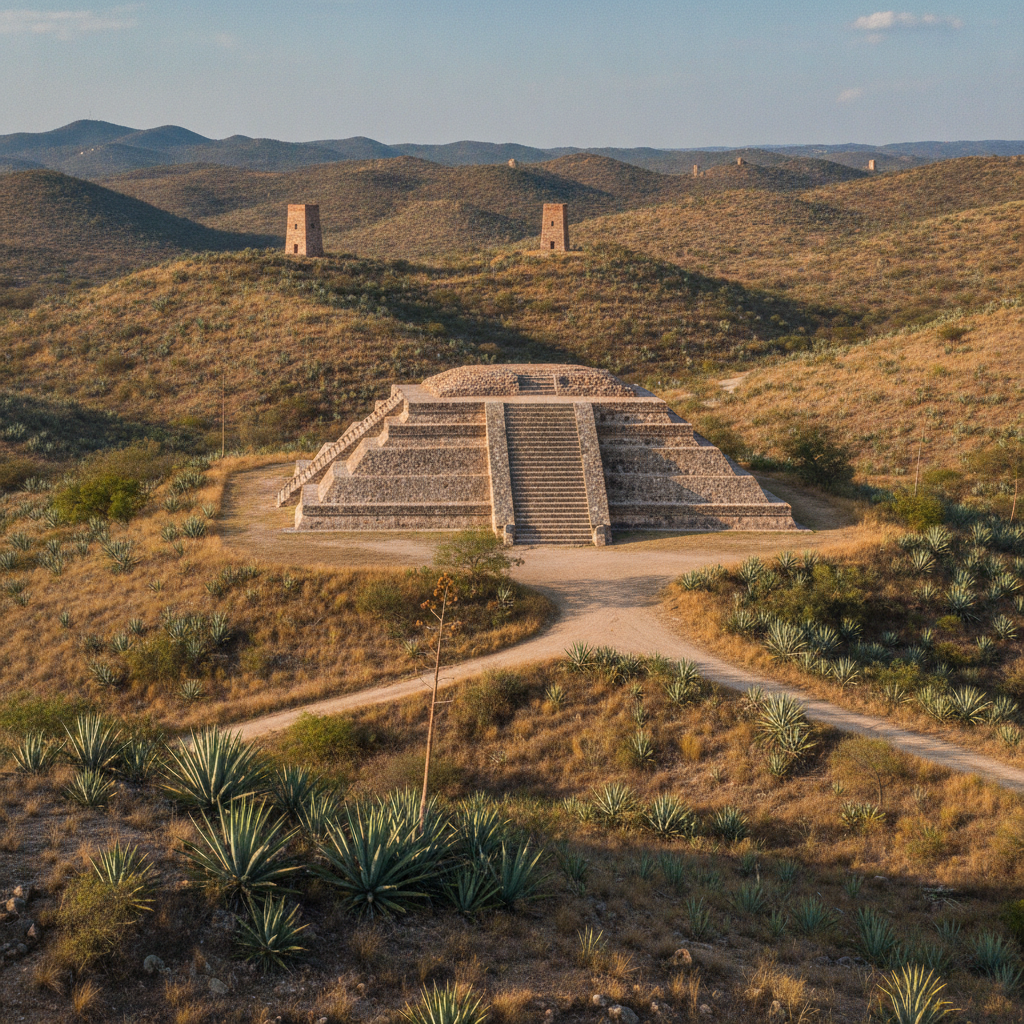
Guanajuato Pre-Hispanic Chichimec Culture the Purépecha Boundary and the Archaeological Heritage of a Region Where Three Civilizations Met at the Northern Frontier of Mesoamerican Settlement
Guanajuato state sits at the northern edge of Mesoamerica, the boundary zone where the agricultural civilizations of central Mexico encountered the semi-nomadic and nomadic cultures of the Gran Chichimeca, creating a frontier region whose pre-Hispanic history is more complex and less well understood than the histories of the core Mesoamerican regions to the south. The territory of what is now Guanajuato state was occupied in the pre-Hispanic period by a succession of cultures that included Chupicuaro, one of the most artistically productive ceramic traditions of ancient Mexico, the Purépecha empire of Michoacan whose expansion in the 15th century pushed into Guanajuato territory from the west, the Chichimec peoples whose territory extended across the semi-arid north, and the Otomi and Mazahua communities of the valleys who maintained agricultural settlements at the southern edge of the Gran Chichimeca frontier. The Chupicuaro culture, centered on the site now submerged beneath the Solis Reservoir on the border of Guanajuato and Michoacan, produced between 500 BCE and 300 CE one of the most distinctive ceramic traditions in pre-Columbian Mexico, with highly polished geometric painted vessels, female figurines with elaborate headdresses, and burial goods of exceptional quality that have been recovered in thousands of excavations since the 1940s. The site of Cañada de la Virgen, 15 kilometres from San Miguel de Allende, is the most significant accessible pre-Hispanic archaeological site in Guanajuato, with a ceremonial complex including a pyramid oriented to astronomical events that documents the presence of an agricultural settlement and ceremonial center in the Bajio highlands between 540 and 1050 CE.
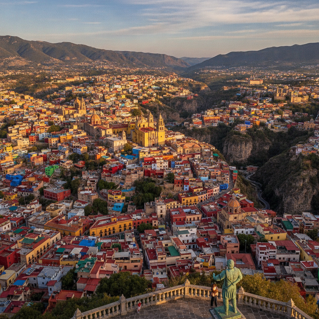
Guanajuato Alhondiga de Granaditas Silver Mines El Pipila Callejon del Beso Teatro Juarez and the Underground Tunnels of a City Built Inside a Silver Canyon That Funded the Spanish Empire for Three Centuries
Guanajuato is the most dramatically situated colonial city in Mexico, built inside the narrow gorge of a silver-bearing canyon whose walls rise steeply on both sides of the main street, forcing the city to grow vertically up the canyon slopes in a dense medieval-like accumulation of colored houses, church towers, and plazas linked by narrow alleys called callejones. The silver mines of Guanajuato, discovered in 1548 by Juan de Jasso, produced an estimated one-third of all the silver mined in the world during the colonial period, making the city one of the wealthiest in the Americas and funding the baroque architecture of the churches, the University, and the mansions of the mining aristocracy. The Alhondiga de Granaditas, the massive stone granary built in 1809 and immediately converted to a fortress during the War of Independence, was the site of the first major insurgent victory when El Pipila, a young miner named Juan Jose de los Reyes Martinez, strapped a stone to his back as a shield against the Spanish defenders fire and crawled to the doors of the Alhondiga to ignite them with a torch, allowing the insurgent forces to storm the building. The statue of El Pipila on the hill above the city, holding his torch aloft in a gesture that is visible from every part of the historic center, is the defining image of Guanajuato against its canyon backdrop. The callejones, the narrow pedestrian alleys that connect the levels of the canyon city, include the Callejon del Beso, the alley so narrow that the balconies of the opposing houses are within kissing distance, around which the legend of star-crossed lovers and the tradition of couples kissing on the third step has made it the most photographed spot in the city. The underground tunnel network, built along the course of the channeled Guanajuato River that flooded the city repeatedly before being redirected underground in the 1960s, now serves as the primary vehicle route through and under the historic center.